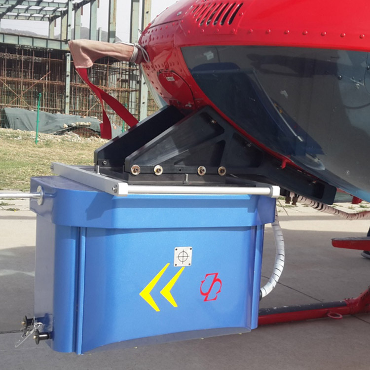
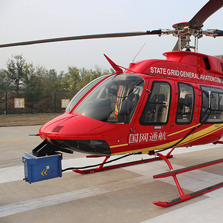


E+AP0500 helicopter inspection system is the power inspection equipment developed by SureStar. The system uses the A-pilot laser scanner as the core and is connected with sensors such as inertial navigation system, aerial photography camera, environmental variables High-precision integration, which has perfect independent intellectual property rights.
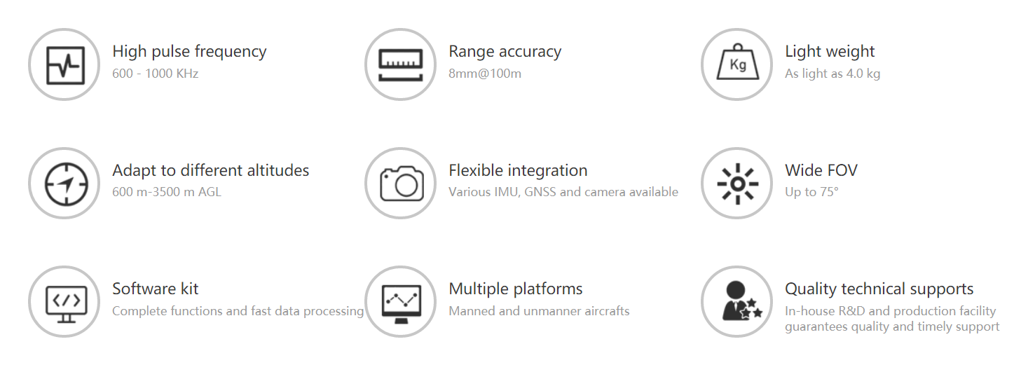
E+AP airborne lidar system has ranged between 50m and 2000m, It has a simple shape, lightweight, and can be easy to install on various flight platforms. It has 70° FOV and up to 600K pulses per second of high scanning density which greatly improves the scanning efficiency. Multiple mounting holes and possible data interfaces are designed on each surface of the device to facilitate the user's system integration with various other sensors.
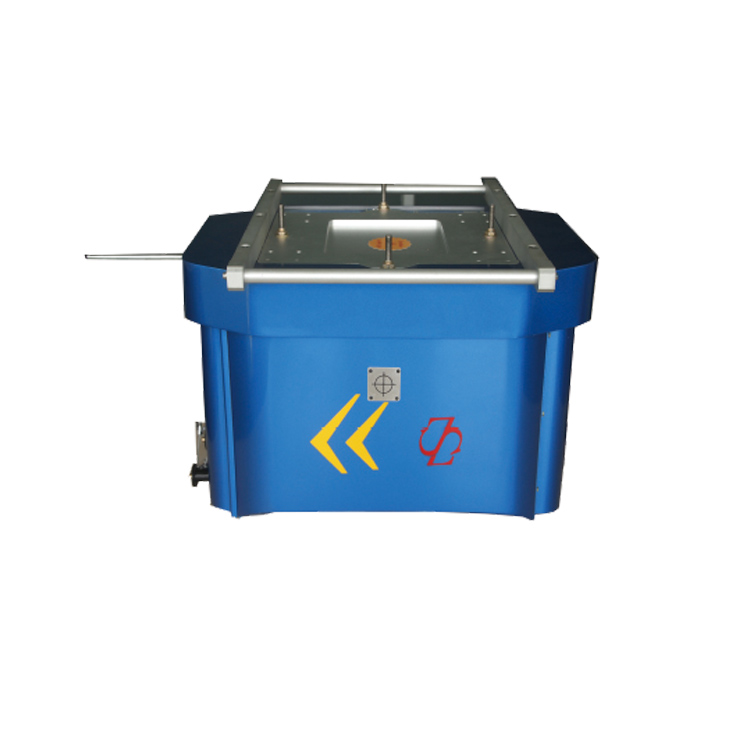
During the development of the E+AP0500 helicopter inspection system, it was customized for production in accordance with the actual requirements raised by the State Grid ’s power inspection operations. The system has high integration, high precision, small size, and lightweight, which is easy to disassemble in the field. The characteristics are mainly reflected in the following aspects:
1) The system adopts modular structure design, which is composed of the pod, control cabinet, and GNSS antenna. Each module is highly integrated and installed independently;
2) The system uses high-precision laser sensors, the absolute ranging accuracy can reach 5 ~ 8mm @ 100m, and the highest point frequency can reach 500,000 points per second, which can clearly describe the structure of the power pole tower;
3) The laser pod is highly integrated and has built-in environmental variable sensors, the overall weight is less than 30 kg;
4) The system supports customized development of software, with a number of special functional module designs for power requirements, including power line tower pole import, pilot navigation, real-time display of point cloud section view, etc .;
5) Configuration of the high-level inertial navigation system, which has higher measurement accuracy.
| Model | E+AP0500 | E+AP2000 | |
| System | Ranging | 1300m | 2000m |
| System measurement accuracy | ±5cm | ||
| Echo mode | 4 echoes | ||
| Pod weight | 28kg | ||
| Scanner | Scanner unit | AP0500 | AP2000 |
| FOV | 70° | ||
| Ranging accuracy | 5-8mm@100m | ||
| Laser class | Class Ⅰ | ||
| Scanning frequency | 600kHZ | ||
| Measuring frame rate | 100HZ | ||
| Integrated navigation unit | IMU frequency | 200HZ | |
| Positioning mode | GPS, GLONSS, GALILEO, BD | ||
| Position accuracy (post-processing) | 0.01m (plane) 0.02 (vertical) | ||
| Heading accuracy (post-processing) | 0.005° | ||
| Pitch accuracy / roll accuracy (post-processing) | 0.003° | ||
| Camera | Optional | ||