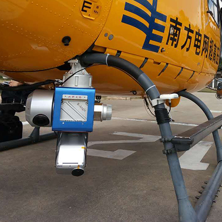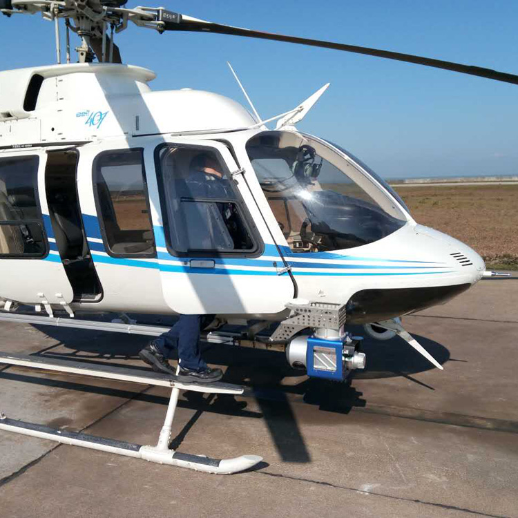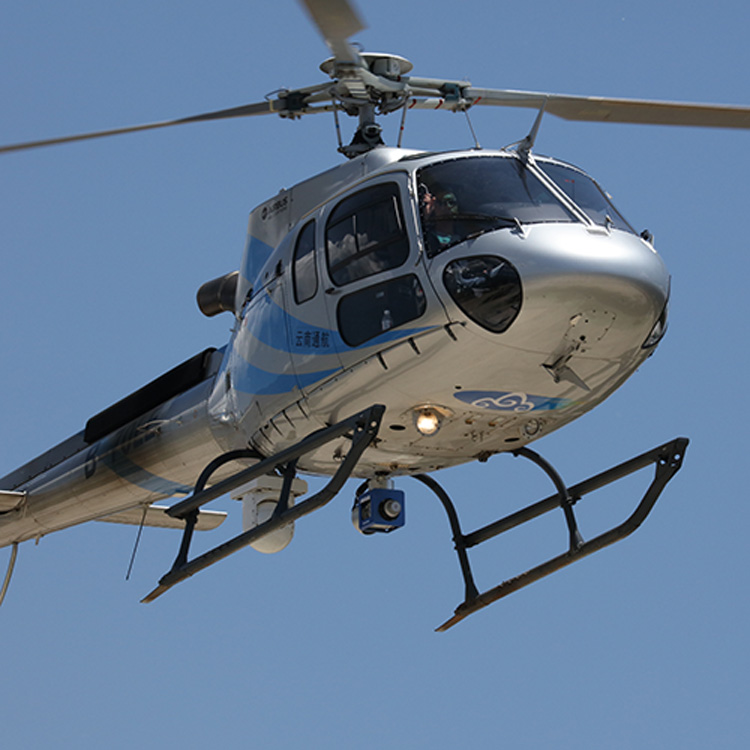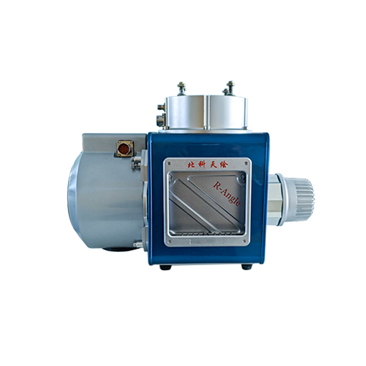
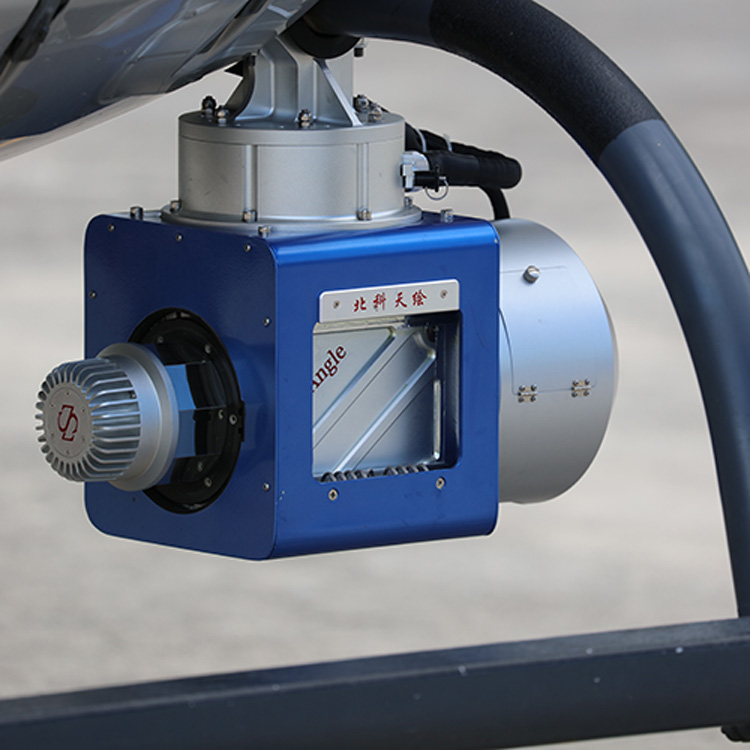


E+RA helicopter inspection system is the power inspection equipment customized for the power industry after many years of exploration by SureSatr. It is based on the high accuracy laser scanner RA1500 developed by SureStar, camera and other sensors, which are highly integrated and integrate multiple positioning modes to obtain massive laser point cloud data and rich image information in real-time and efficiently.
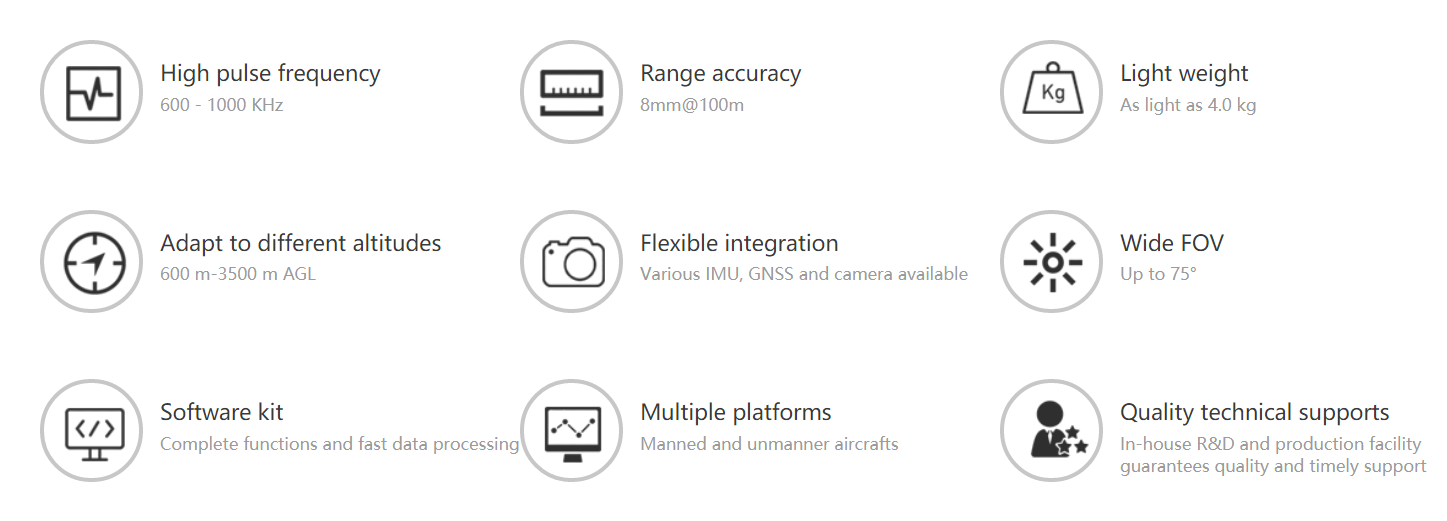
In the process of R&D, the system is customized for production in accordance with the actual needs of the power grid department. The system has the characteristics of high integration, high precision, small size, lightweight, and easy disassembly and assembly in the field, mainly reflected in the following aspects:
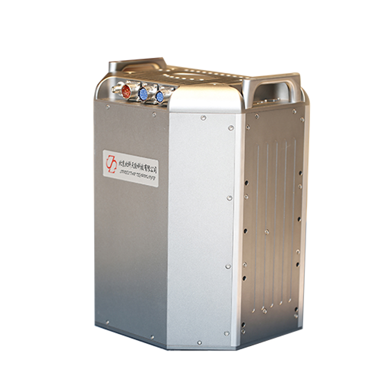
1) The system is composed of laser pod, power module and GNSS antenna, each module is highly integrated and installed independently;
2) The system uses high-precision laser sensors, the absolute ranging accuracy can reach 5 ~ 8mm @ 100m, and the point frequency can reach up to 600,000 points per second, which can clearly describe the structure of the power tower pole;
3) The system is supported by custom-developed software, with multiple functional module designs for power requirements, including the import of power line tower poles, pilot navigation, and real-time display of point cloud section view.
| Model | E+RA0600 | E+RA1500 | |
| System | Ranging | 1000m | 2000m |
| System measurement accuracy | ±5cm | ||
| Echo mode | 4 echoes | ||
| System weight | 16kg | ||
| Scanner | Scanner unit | RA0600 | RA1500 |
| FOV | 360° | ||
| Ranging accuracy | 8mm@150m | ||
| Laser class | Class Ⅰ | ||
| Scanning frequency | 1200kHZ | ||
| Measuring frame rate | 200HZ | ||
| Integrated navigation unit | IMU frequency | 400HZ | |
| Positioning mode | GPS, GLONSS, GALILEO, BD | ||
| Position accuracy (post-processing) | 0.01m(plane)0.02(vertical) | ||
| Heading accuracy (post-processing) | 0.009° | ||
| Pitch accuracy / roll accuracy (post-processing) | 0.005° | ||
| Camera | Optional | ||