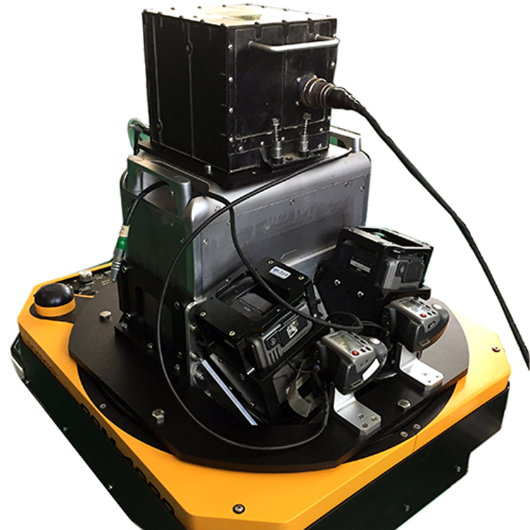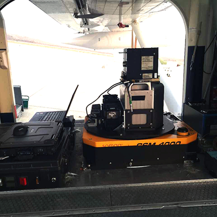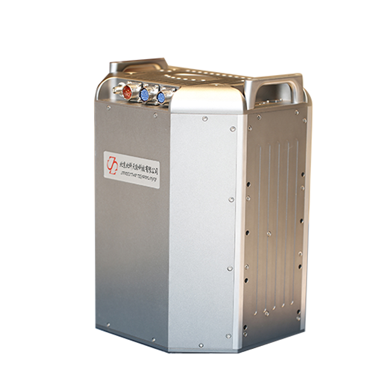


The AP3500 airborne LiDAR system is a high-altitude airborne LiDAR device developed to meet the needs of China's mountainous landforms and efficient aerial survey operations. It can provide unique multi-echo measurement data, which means one laser can measure the distance of multiple levels of targets. This is a significant feature for the investigation of forests and vegetation and also can be widely used for various high-efficiency, high-precision 3D data collection of power line patrols, 3D city information modeling, cadastral survey, deformation monitoring, water conservancy survey, disaster assessment applications in the field of measurement.
In the software design process, SureStar also considered the user later uses of the airborne integrated system. The control software Win-Nav matched with E + AP can easily control the entire integrated system, including GPS and IMU, and even the camera. Its preprocessing software UI-AP can perform fast and accurate data preprocessing on track data and scan data to form a point cloud. These point cloud data can be directly used for various three-dimensional measurement, calculation or digital modeling. At the same time, UI-AP can output a variety of three-dimensional data formats (customizable), so that users can easily apply to various point cloud data post-processing software on the market.
Features of the product:
Compared with other products of the same type, the AP3500 LiDAR system has the characteristics of long-range, fast speed, high accuracy, flexible integration, and a wide range of platforms. The core parameters can meet 1: 500, 1: 1000 and 1: 2000 conventional scales requirements for surveying;
With perfect after-sales service and security system, domestic scanners have localized service advantages, as long as customers need to arrive at the scene within 24 hours for technical service;
With more than ten years of R & D technology reserves, the core performance of products has basically reached the world's advanced level.
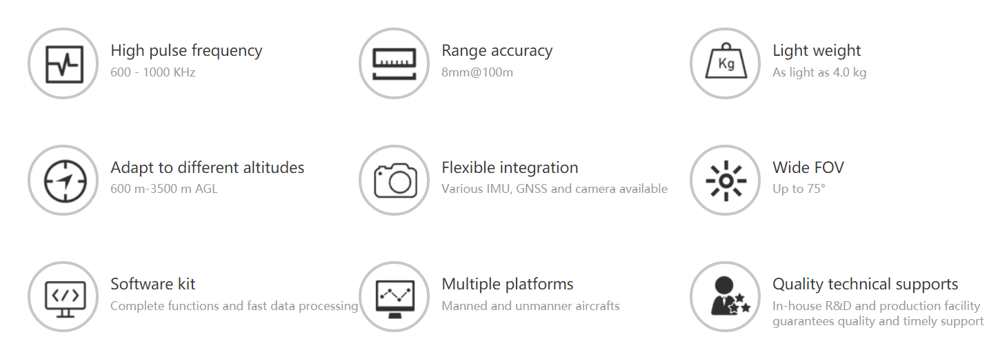
| Model | AP3500 | |
| System | Ranging | 3500m |
| System measurement accuracy | ±5cm | |
| Echo mode | 4 echoes | |
| Pod weight | <50kg | |
| FOV | 70° | |
| Ranging accuracy | 20~30 mm@500 m | |
| Laser class | Class Ⅳ | |
| Scanning frequency | 600kHZ | |
| Measuring frame rate | 100HZ | |
| Integrated navigation unit | IMU frequency | 200HZ |
| Positioning mode | GPS, GLONSS, GALILEO, BD | |
| Position accuracy (post-processing) | 0.01m (plane) 0.02 (vertical) | |
| Heading accuracy (post-processing) | 0.005° | |
| Pitch accuracy/roll accuracy (post-processing) | 0.003° | |
| Camera | Optional |