
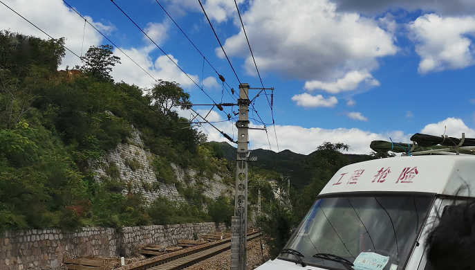
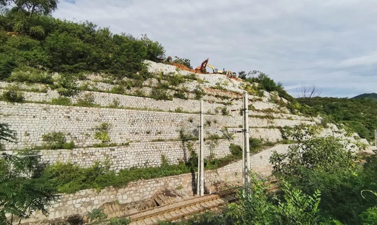
A debris flow disaster occurred in a railway section in Hebei, which caused the road to be interrupted and impassable, which seriously threatened the safety of railway transportation. After a major disaster occurs, obtaining accurate post-disaster image maps and other data as soon as possible is the key to understanding disaster information and guiding rescue efforts. The technicians acted quickly without fear of wind and rain, and embarked on an emergency measurement trip overnight. After surveying the site and having a general understanding of the situation, they quickly formulated a measurement plan to eliminate danger and ensure road transportation safety.
Survey area overview
Target survey area: landslide area of a railway section in Hebei
Difficulties in the survey area:
In case of landslide emergency in railway section, first-hand surveying and mapping results are urgently needed, and time is urgent;
Along the mountain railway, the environment is harsh, and there is almost no good work site;
There are many construction units and personnel on site, and the conditions are complex
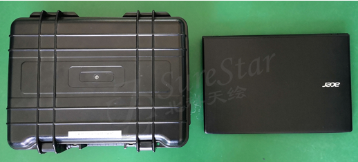
Emergency equipment
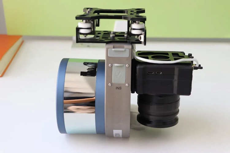
Light weight: 1056g is perfect for DJI M210/300/600 series drones
Long range: the maximum range is 250m, and the maximum flight height is 150m, which can ensure the safety of flight operations in the case of complex terrain and electromagnetic interference
High accuracy: the error in distance measurement is better than 2cm, and the system elevation accuracy is better than 10cm
Fast speed: 320,000 pts/s, point density > 200pts/m²
Convenient operation: no base station operation, one-key start
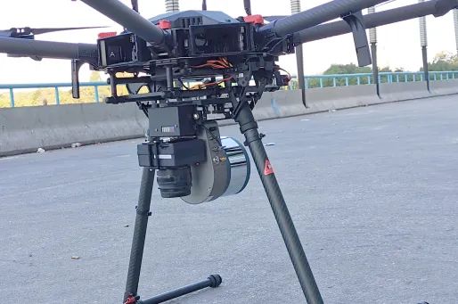
DJI M600 Drone
Support Genius Pro (with camera) version, synchronous acquisition of lidar and image data, effective operation time exceeds 20 minutes;
Emergency capability
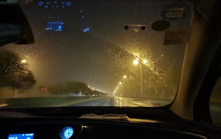
Long-distance raid
1
Equipment preparation
In emergency projects, speed is everything. Therefore, it is required to be "steady" and "fast" in every link.
The first time the project was received, the technicians completed the system inspection and packing within 5 minutes. And the system supports base station-free operation mode, which saves time for preparing base station, RTK and other auxiliary measurement equipment.
2
Day and night
After the lidar system is packaged, the size is only similar to the size of a writing notebook, which is easy to carry. You can directly choose any means of transportation to rush to the project survey area at the fastest speed.
The system power supply equipment can be powered by Genius independent battery or powered by the flight platform, which can be quickly charged according to the conditions on the way to the site, reducing the preparation time after reaching the site;
3
Quick job
Genius Pro (with camera) version, 250m maximum laser ranging, compatible camera 4200W pixel, 61*81° field of view miniature camera, so in emergency projects, the restrictions on flight height and route spacing can be fully relaxed, and the survey area can be quickly obtained The high-overlap point cloud data and image data ensure the stable and reliable quality of the later data results.
The flight height of this operation is changed according to the on-site terrain, the overall height above the ground is about 60m, and the speed is 6m/s;
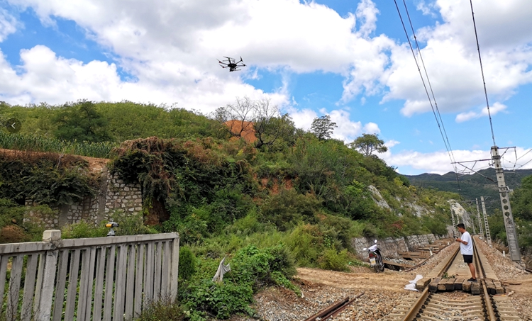
The Genius lidar emergency system supports base station-free operation without the need to set up a base station. The equipment takes off directly after the inertial navigation initialization is turned on, and the PP-RTX base station-free service is used in the data processing process to quickly perform GPS differential calculation and obtain high-precision trajectory results.
The flight operation included preparation time of only about 25 minutes, and completed the collection of radar data and orthophoto image data for the entire survey area.
4
Data field solution
The trajectory calculation time is about 10 minutes. After the calculation is completed, the trajectory accuracy analysis can be viewed in the software in real time to ensure the reliability of the trajectory results;
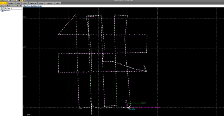
Use UI-RFans for point cloud calculation, the original data is 2G, and the calculation time is about 10 minutes; after the calculation is completed, the las point cloud file can be directly obtained after geodetic orientation according to the target ellipsoid and projection, which can be browsed synchronously in the software, It can also be exported to other software for post-processing editing;
Data situation
1
Raw data
POS: 50.9M; Radar data (isf): 1.8G; Image data: 8.4G
2
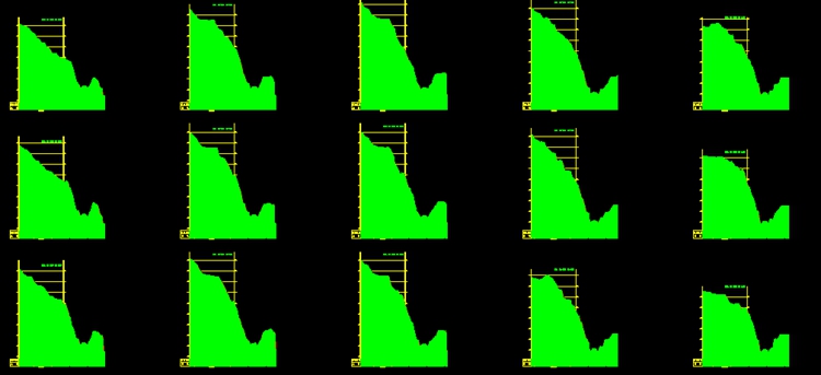
Track accuracy
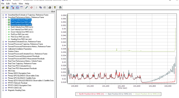
Track position accuracy
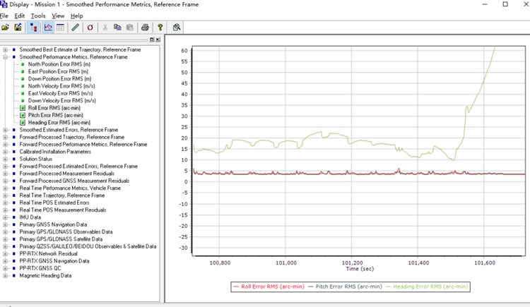
Trajectory Attitude Accuracy
3
Outcome data
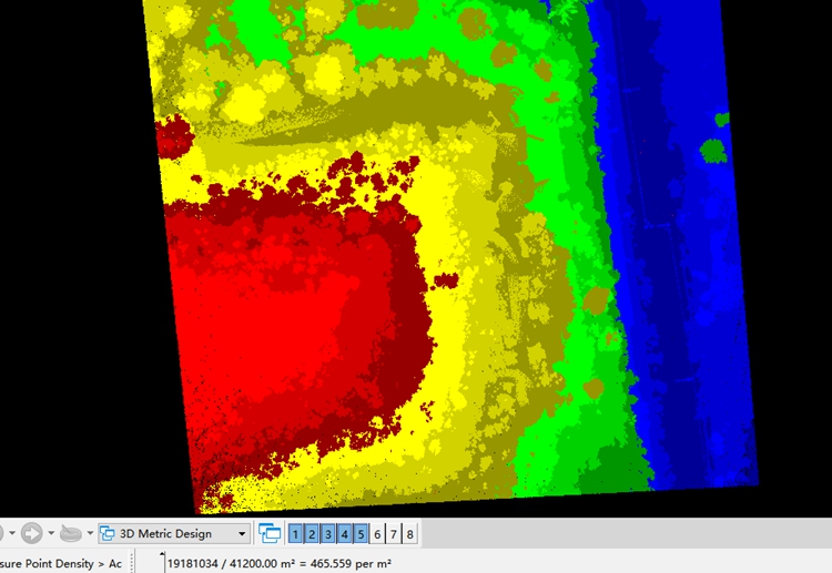
The overall point density is 466 points/㎡
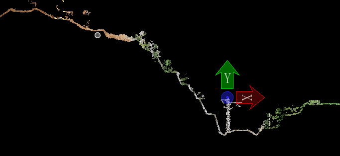
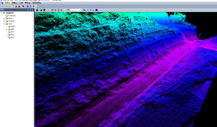
The profile clearly reflects the slope and appendages along the line
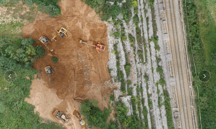
Visual image of emergency construction status and landslide status
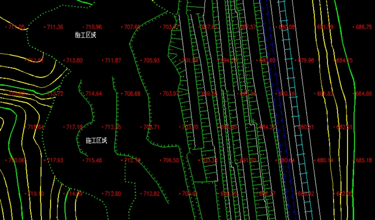
Landslide Slope Plan
Landslide Slope Elevation
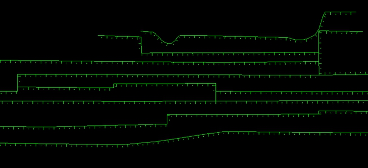
Cross-section of landslide area
Summarize
Thanks to the highly integrated and light-weight features of the Genius system, in this railway landslide emergency surveying and mapping project, the urgency of the emergency project's time requirements has been effectively met. From receiving the emergency notification to going to the scene, operating the flight, and outputting the results, the first-hand information and results supporting the formulation of the emergency plan were provided within 20 hours. It takes less than 5 hours from the actual work on site to the output of the results. Genius quickly and efficiently completes emergency surveying and mapping projects, reducing further loss of life and property caused by similar earthquakes.