
Recently, the 2021 Zhongguancun Forum series activities, the first launch of new technologies and new products, and the third phase of the international cutting-edge project road show-artificial intelligence and intelligent manufacturing special session were held at the Conference Center of the Exhibition Center of Zhongguancun Demonstration Zone.
More than 50 enterprise projects in the field of artificial intelligence and intelligent manufacturing were solicited for this event, and 13 cutting-edge new technologies and new products were launched on-site.
In the forum series of activities, a lidar product called "StarScan" attracted the attention of reporters on the spot!
The StarScan of Surestar showed its edge
01 High-precision SLAM algorithm of "StarScan"
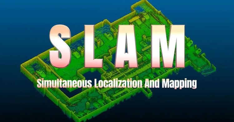
SLAM (Simultaneous Localization And Mapping) means synchronous positioning and mapping. It seems to be a particularly professional and difficult technical concept, but in fact, it is not complicated to understand SLAM.
For example, the process of visiting a park or exhibition for the first time can be roughly divided into the following five steps:
See and remember the markers in your surroundings;
According to the information seen by the eyes, construct a "map" with the location of the marker in the mind;
As one's position changes, constantly see and remember new landmarks, expand the scope of the "map", and revise details at the same time;
Determine your current position in the park or exhibition hall according to the "map" that expands the scope and corrects the details in your brain;
After walking for a while, by comparing the "map" in your mind with the things in your vision at the moment, you can confirm whether you have been to this place before and whether you have gone the same way.
The principle of SLAM is actually very similar to the process described above, except that it is completed by machines and equipment, rather than "living people." SLAM usually includes the following parts, feature extraction, data association, state estimation, state update and feature update. In layman's terms, "open the map while walking", similar to how we play real-time strategy games.
02 Simple operation and powerful "StarScan"
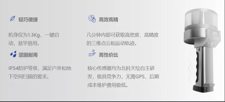
"StarScan" has a core 3D ranging of 200m and a pulse frequency of 320,000 points per second. A 5000m² work area, from data collection to data processing, only takes 10 minutes to complete the work.
During the "StarScan" design and development process, Surestar conducted massive data collection experiments in order to continuously optimize the error model algorithm. Finally, this handheld laser 3D scanner achieved centimeter-level absolute data accuracy.
Coupled with its point cloud thickness of less than 10cm, it jointly supports the "StarScan" to obtain high-precision, high-density three-dimensional point cloud and motion trajectory measurement capabilities, so that all details in the target area of the operation are detailed.
In addition to excellent basic surveying and mapping parameters, StarScan's small body also integrates many technologies that can enhance surveying and mapping performance. For example, the 9-degree-of-freedom inertial navigation system enables StarScan to achieve accurate measurement and free operation even when the ground is undulating, the working position or the target has an inclination angle.
In addition, "StarScan" also adopts tilt compensation technology, supports automatic correction of horizontal ±10°, and can collect data from multiple angles and all directions. For example, when scanning power poles, towers, and high-rise building facades, surveying and mapping personnel on the ground can use "StarScan" to easily obtain complete 3D point cloud data and related information.
"StarScan" also supports operations at a moving speed of 2m/s. For vehicles and even humans, this speed may seem very slow, but in the surveying and mapping process, especially when using handheld devices for surveying and mapping, 2m/s can be called "fast movement".
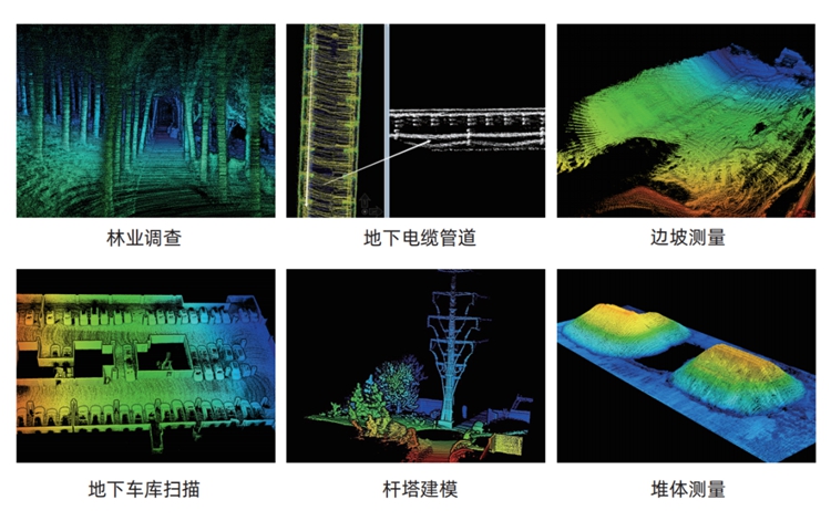
With the support of the SLAM algorithm and many technologies, "StarScan" can calmly face the surveying and mapping operations of different scenes, sites, and tasks. It can scan indoor and underground spaces in buildings, volume measurement, agricultural and forestry surveys, municipal gardens, and electric power inspections. , Poles, towers, and building facade modeling, etc., can complete the work with high quality and quantity and cost-effectively.
The accumulation of Surestar in the field of lidar for more than ten years has allowed many technical capabilities to be condensed in the small body of the "scout"!
As a result, it showed a comprehensive and dazzling light in the 2021 Zhongguancun Forum series activities, the first launch of new technologies and new products and the third phase of the international cutting-edge project roadshow-artificial intelligence and intelligent manufacturing!