
01
Exercise Background
In order to better improve the response ability of the emergency surveying and mapping team and the organization and coordination ability of various departments, timely and effective access to geographic information of sudden disasters, ensure that emergency rescue and disaster relief can be carried out in an efficient and orderly manner. Shenzhen Municipal Bureau of Planning and Natural Resources organized emergency drills on surveying and mapping in Shenzhen.
02
Drill Requirements
Assuming that the mountains on the northwest side of the Dakeng Reservoir Dam, Dalang Street, Longhua District, Shenzhen, landslides occurred due to continuous rain, the mountain structure was unstable, and some slopes were likely to have major geological hazards of landslides again, which seriously threatened the surrounding buildings and large buildings. The dam body of the pit reservoir is safe. Organize the use of UAVs and airborne lidars and other equipment to quickly obtain the latest video, orthophoto, laser point cloud and other data of the incident site, and provide relevant data to decision-making departments after relevant processing.
03
Emergency Equipment
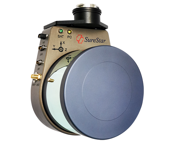
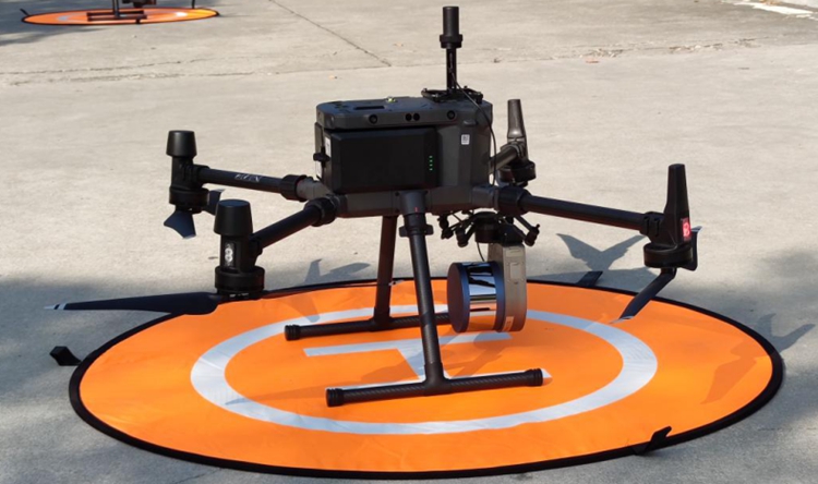
· Light weight: the device weighs 1056g, and the skyport interface is directly compatible with the DJI M300 drone;
· Convenient operation: support base station-free operation and one-key start;
· Long distance measurement: the maximum distance measurement is 250m, and the supporting working height is 150m, which can meet the operation in complex environments;
04
Emergency Operation

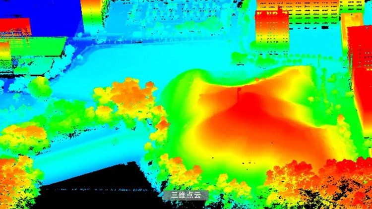
The efficiency and convenience of emergency rescue is not only reflected in flight operations but also in data processing
· 10:00 Emergency drill officially started;
· 10:20 Lidar data flight completed;
· 10:35 Laser point cloud data processing completed;
· 10:45 Point cloud data classification completed;
· 10:50 DSM, DEM, contour lines are completed;
· 10:55 The earthwork calculation is completed and the result data is submitted.
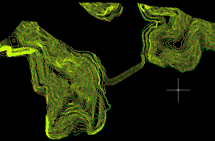
Contour Line
In the industry software, one-click volume calculation is performed by the triangulation method according to the benchmark elevation surface and the digital surface model and the calculation range line. This time, 126m is used as the calculation base elevation, and the calculated earthwork volume is: 282945.94m³.
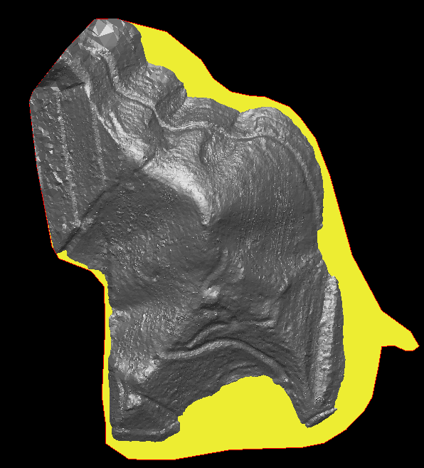
Earthwork Calculation Scope
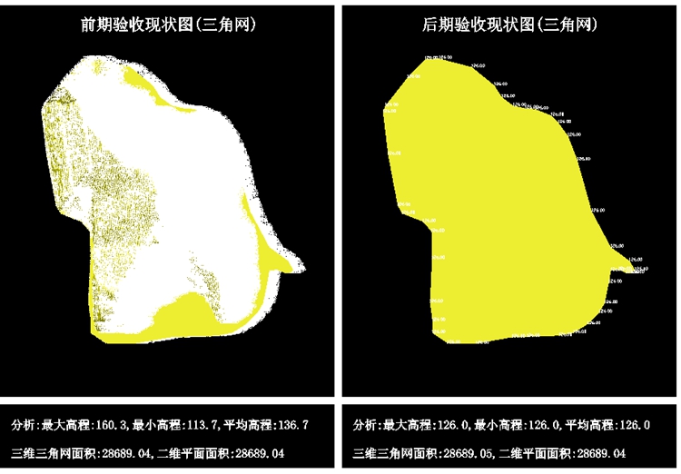
Earthwork Calculation
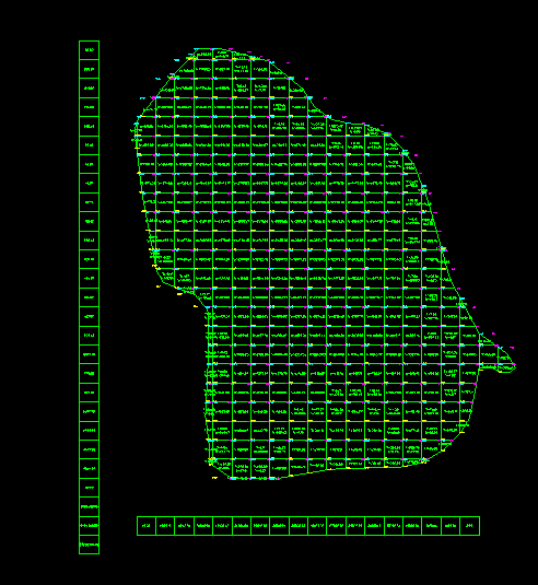
Earth Grid
Summarize
Emergency surveying and mapping are mainly concerned with the speed of data acquisition, data processing speed and data accuracy.
Convenient operation: Quickly mount Genius equipment, start operation with one key, data collection is very convenient;
Efficient processing: It only takes three steps to obtain high-precision earthwork volume, and the degree of automation of point cloud preprocessing, point cloud classification, and earthwork calculation is high.
High precision: The absolute elevation accuracy of Genius LiDAR is within 10cm, which can provide accurate earthwork in the survey area.