
 Background of the project
I am often asked by customers that I have a small survey area here and need to obtain high-precision laser point cloud data. The drop of the survey area is hundreds of meters. Before, we always recommended our long-range lidar solutions Skylark and Yunying. Because the maximum measuring range can reach 1500m, there is no fear of large drop; but because the scale of the project itself is not large, the cost of calling long-range equipment is a bit high.
The biggest advantage of Genius is that it is light, flexible, convenient, and highly maneuverable. However, because its maximum measuring range is only 250m, the level flight operation cannot be applied to data acquisition in areas with large drop, and an operation scheme that can support ground-flight flight is urgently needed. It is used for the acquisition of high-precision laser scanning data with small area and large drop.
Genius+DJI M300 RTK+WayPoint Master is the best CP to solve this problem.
Statement: The following cases are supported by Guizhou Yuntu Kanjing Geographic Information Technology Co., Ltd.
Survey area overview
Location of the survey area: Southwest China, by the Beipan River;
Survey area: 4 kilometers long, 2 kilometers wide, and 8 square kilometers;
Terrain: mountainous area, the lowest elevation is 596m, the highest elevation is 1304m, and the drop is 708m;
Landform: Southwest mountainous area;

 Data Outcome Requirements
Achievement requirements: point cloud data, digital elevation model, contour lines;
Achievement accuracy: the elevation accuracy is better than 20cm;
Project difficulties
The drop is large, within a range of 2 kilometers wide, the drop reaches 700m;
 Work plan
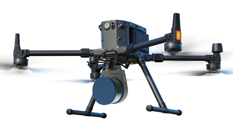
Laser equipment: Genius;
Carrying flight platform: DJI M300 RTK;
Route planning software: WayPoint Master;
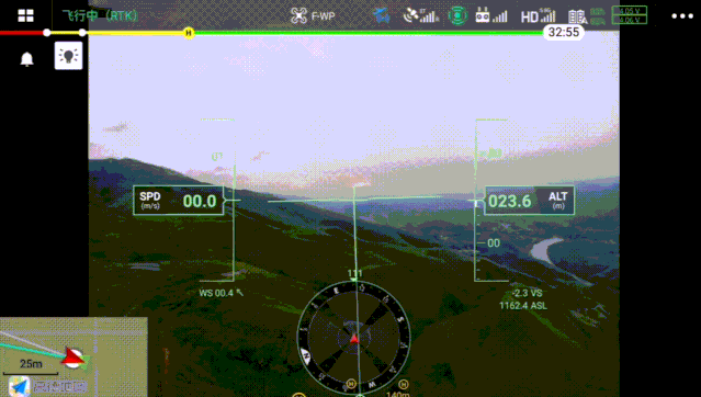
Operation mode: flying imitating the ground, maintaining a clearance height of 120m;
Data settlement mode: PP-RTX free base station;
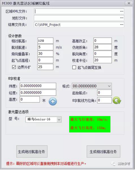
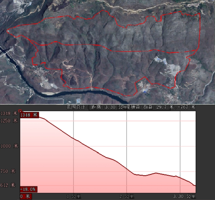
WP Master route planning interface
Field data acquisition
1. Route planning
According to the range line of the survey area, use the matching ground imitation flight route planning software WayPoint Master to load the DEM model of the survey area, select the flight parameters of the Genius airborne lidar, set the relative flight height to 120 meters, the flight belt spacing to 100 meters, and the flight speed to 10 meters. /s; The software automatically generates a ground-imitation flight route, and calculates the output flight duration and total flight kilometers. The exported routes can be directly imported into the DJI M300 UAV flight platform.

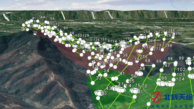
Plan the route by imitating the ground
2. Flight operations
This flight operation adopts the PP-RTX data post-processing mode, and there is no need to set up a base station on site; the Genius equipment and the UAV are installed, and the upload route detection equipment is in normal condition, and the operation can be performed directly.
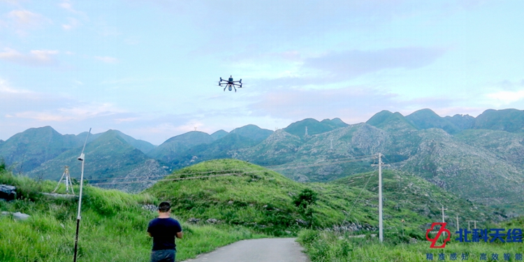
Since the net weight of the Genius is only 1056g, the effective endurance time of a single sortie is still as high as 30 minutes even if it is mounted on the M300 to cope with the high-drop flight mission.
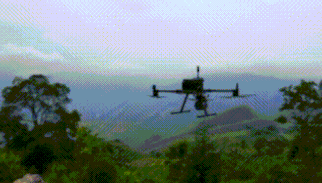
3. Night flight data collection
Taking into account the excitement of the partners and the tightness of the construction period, the night flight certainly cannot be absent;
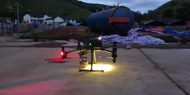
As of 8:30 that night, with ten sorties, the acquisition of lidar data in the entire survey area of about 8 square kilometers was officially ended.
 Data preprocessing checks
1. Settlement of trajectory and point cloud data
The original data is backed up and archived, the track and point cloud data are settled by the data preprocessing software provided by the system, and the LAS point cloud file in standard format is output.
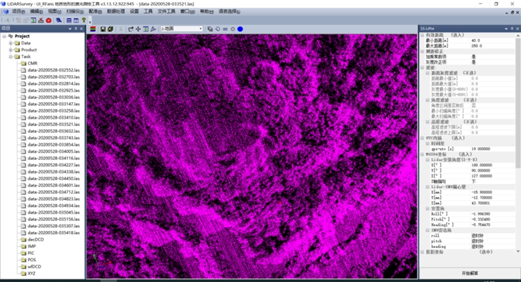
Point cloud data preprocessing
2. point cloud data inspection
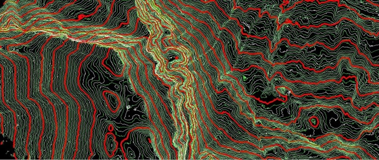
According to the project requirements, the output point cloud result is CGCS2000 coordinate system, and the elevation is the height of the earth; point density: 112 points/square meter;

Raw point cloud point density
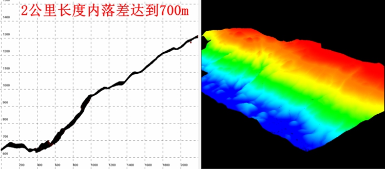
Point cloud cross section shows drop
Data post-processing
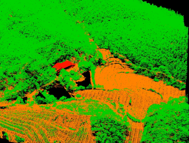
Point cloud classification
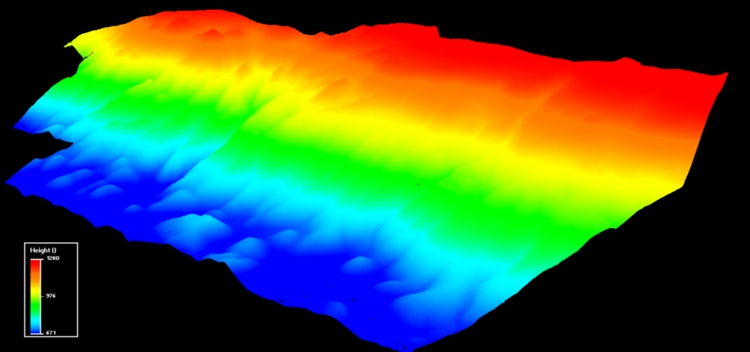
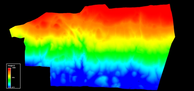
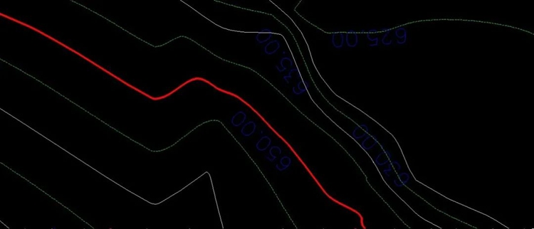
Digital Elevation Model DEM
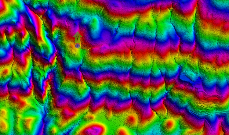
Contour line
 Accuracy check
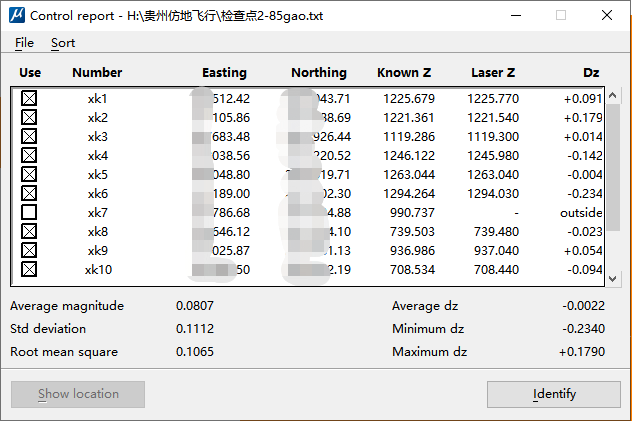
1. Inspection method
Lidar measurement belongs to active geo-reference positioning measurement, which relies on high-precision combined inertial navigation to directly obtain the spatial coordinates of ground objects without the need for control points. In order to verify the accuracy of the point cloud data, some inspection points were measured by RTK in the bare and flat area of the survey area. The inspection points were distributed in different sortie areas, and the coordinates of the inspection points were used as the true value to compare with the laser point cloud data , the error in the statistical elevation is used as the check result.
2. Inspection results
The RTK measurement coordinates and the laser point cloud data are checked, and the error in the checked elevation is 10.6cm, which meets the project requirements.
【Project Summary】
1. Imitation flight
The drop of the survey area reaches 700m, and although the maximum distance of the Genius is only 250m, it can be applied to the acquisition of terrain data in large drop areas through the ground imitation flight operation mode.
2. Free base station
The post-differential processing of Genius data can be settled through the PP-RTX mode, eliminating the need to set up a base station on site and realizing single-person flying operations.
3. High efficiency
Genius+M300 RTK single sortie operation efficiency is better than 0.8 square kilometers, and 8~10 sorties per day can complete data collection of nearly 10 square kilometers.
4. High precision
Genius+M300 RTK base station-free operation mode, the elevation accuracy of terrain mapping results can reach 10cm, which is better than the elevation accuracy requirement of 1:1000 terrain mapping, and actually meets the 1:500 lidar data acquisition specification for mountainous areas. The elevation accuracy of laser point clouds Requirements (CH/T 8024-2011).