
March is the golden construction season for drilling operations in a year. With the rapid start of various operations, for the oil industry, digital transformation can effectively prevent and control oil and gas well control safety risks, reduce personnel injuries, and provide follow-up benefits. Rescue work provides key information and operational deployment conditions, and is also a necessary means to enhance disaster emergency response capabilities and reduce disaster losses.
Digital twins are the source of digitization in drilling
The oil industry attaches great importance to the construction of emergency rescue forces, and strives to improve the ability to respond to and handle sudden safety production incidents. The three-dimensional modeling technology of lidar point cloud data plays an important role in the well control emergency response system. So as to achieve unmanned detection of surrounding terrain and coordinate information, strengthen worker safety, and explore foreseeable maintenance opportunities.
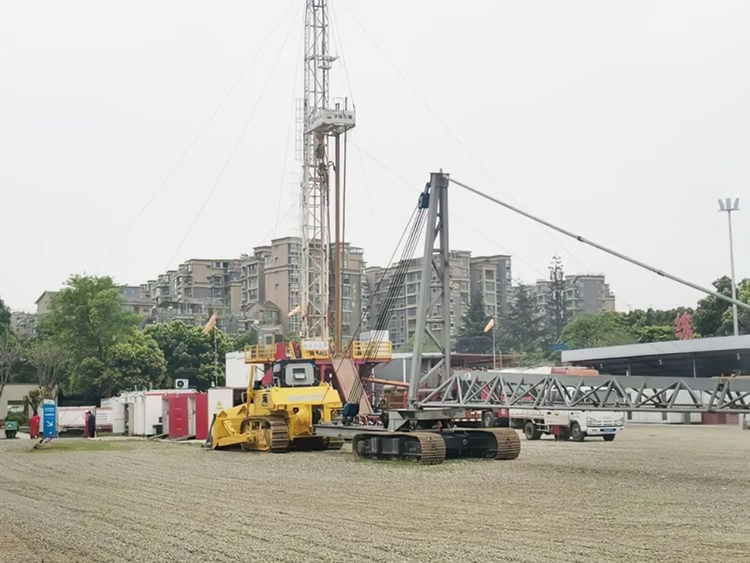
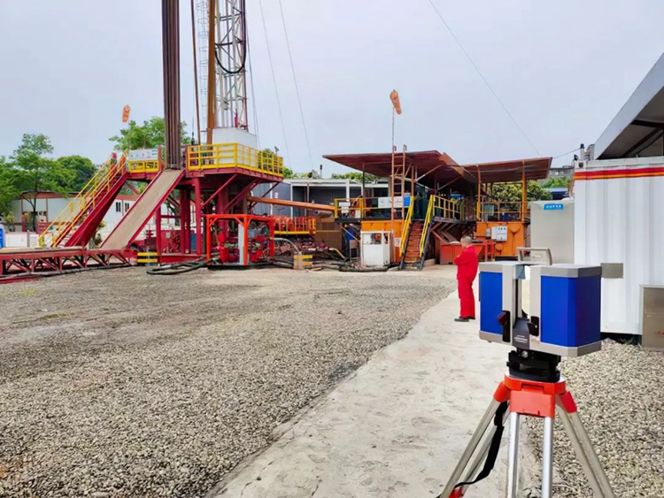
A drilling site in Sichuan Province
Two working modes of Genius UAV LiDAR+U-Arm Terristrial LiDAR
Strong support for drilling well control safety
01
Genius UAV LiDAR+DJI M300
The altitude over the ground is 50m, the bow-shaped route, the flight speed is 6m/s, the bandwidth is 25m, and one flight operation (because the survey area is a no-fly zone, the flight height can only fly 50m after the lifting of the ban).
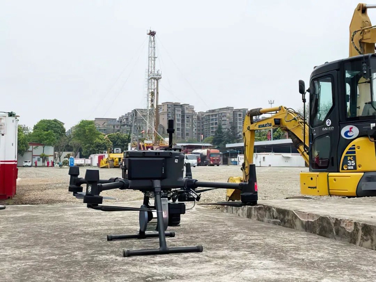
Genius UAV LiDAR+DJI M300 battery life is better than 40min
The point density is >402.2pts/m², and the response to the ground objects in the survey area is fine and accurate, providing a solid guarantee for rapid data processing.
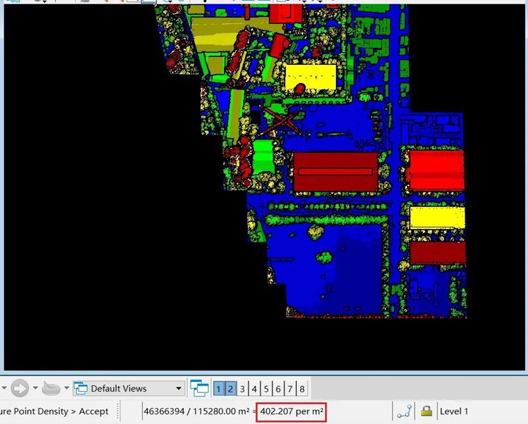
area point density
The side information of the house is complete, and the outline of the eaves is clearly visible.
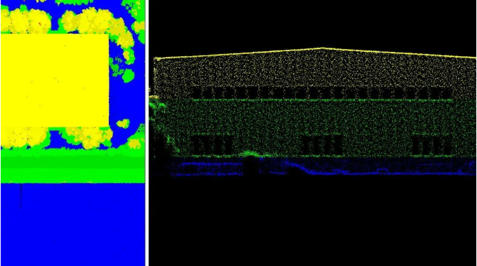
The real object information is obtained by adding RGB information to the point cloud.
02
Ground Stand Station Laser Scanner U-Arm Terristrial LiDAR
According to the site conditions, the LiDAR location is selected, and three stations are scanned for splicing. Each station scans for 3 minutes, and the data stitching is completed in 9 minutes.
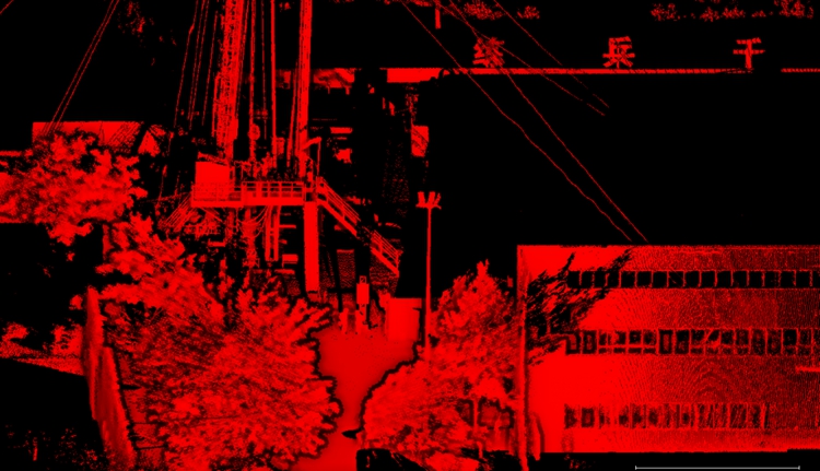
Scan the scene
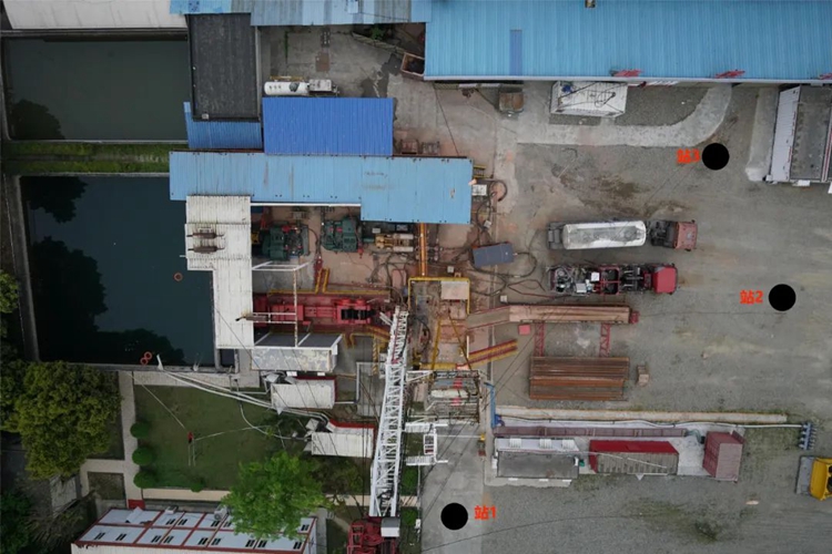
Multi-station collection location selection
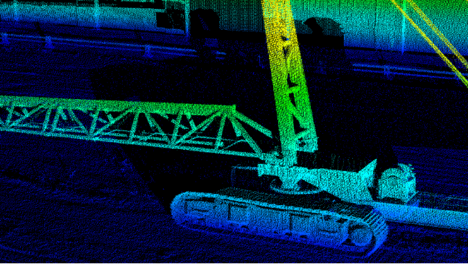
Single site cloud effect
In the future, the digital twin platform based on edge intelligence will further deepen the integration of the physical world and the information space, and become an important carrier of digital transformation and the fourth industrial revolution. With the continuous development and iteration of technology, the application scenarios of digital twins will gradually increase, and the value created will also expand. Digital twin is also the key direction for the oil and gas industry, and even the entire manufacturing industry, to optimize engineering systems, improve business levels, and achieve high-quality development.(www.isurestar.net)