
01
Introduction
When doing UAV surveying and mapping, first of all, we need to consider which products are more suitable, economical and efficient for the current project according to the on-site environment of the survey area. This is beyond doubt. Such a simple truth has also become a key reference for solving problems.
This project is located in a test area near the Guangdong Provincial Institute of Land and Resources Surveying and Mapping. The project requirements need to verify the accuracy of elevation data in the dual coordinate system of WGS84 and CGCS2000.
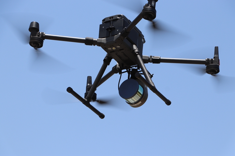
Surestar's self-developed Genius
Micro UAV LiDAR System
The area of the survey area is about 0.06km², the terrain is particularly flat, the highest point of the building is only 45m, and there are vegetation, zebra crossings and buildings. For the observation and selection of point clouds for surveying and mapping, Surestar recommends the Genius micro-UAV LiDAR system as the first choice.
This because Genius is more suitable, economical and efficient for this project. Let's take a deep dive into each of the projects to understand them one by one.
02
Genius Advantage
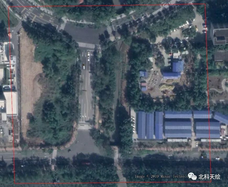
Surestar's Genius Flight Area Environment
Advantage 1: low-altitude operation, flexible and convenient
As mentioned earlier, the terrain in the test area is flat, and the highest point of the building is only 45m. The operation altitude requirements belong to low-altitude detection. The typical operating altitude of the Genius LiDAR system is 50m~150m. The superior low-altitude performance makes flight operations a breeze. There are abundant vegetation, zebra crossings and buildings in the area, which can also be used as a reference. In addition, Genius does not require a dedicated take-off and landing site, has lower requirements for meteorological conditions, and is naturally more adaptable to the environment.
Advantage 2: Small size and light weight
The Genius micro-UAV LiDAR is mounted on the M600 UAV platform. Friends who follow us should know that the total weight of the upgraded Genius system is only 1.168kg, of which the scanner weighs only 738g, which can be easily carried on the DJI M200/M210 UAV platform. And replaced by the new drone platform M600, Genius can also easily connect to it. In addition to its strong compatibility, this is also directly related to the lightweight body of the Genius LiDAR system.
Advantage 3: Modular integrated design
The Genius-32 line lidar is also independently developed by Surestar. Applanix's MEMS high-precision inertial navigation measurement system, combined with the ground static reference station data, can finally solve the trajectory situation with absolute coordinates. Including cameras and spectral sensors, can be adjusted according to the specific needs of the project.
Advantage 4: Long measuring range, high frequency, high precision
The longest distance measurement of Genius is 250m, the measurement speed is 640,000 points per second, the system ranging accuracy is 2cm, and the absolute accuracy is better than 10cm, which can meet the topographic mapping work with a maximum scale of 1:500.
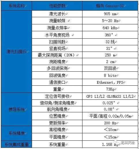
Genius 32-Line LiDAR System Parameter Table
03
Project data processing
The situation of the project and Genius has been described above, and it has entered the demonstration stage. The technicians first set up a static base station according to the on-site environment, set the static acquisition frequency to 2Hz, receive GPS, Beidou and Galileo satellite systems, and then assemble the Genius system and mount the M600 drone, and plan the route so that the equipment can automatically complete flight mission, and finally return home automatically.
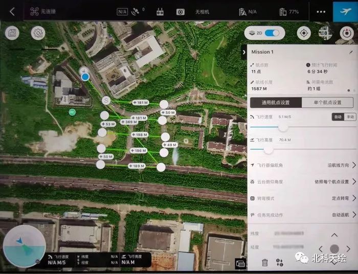
Genius flight route map
The area of this survey area is about 0.06km², and the total route length is 1587m. The technicians set a total of 11 waypoints, the flight altitude is 70.4m, and the route interval is 50m. After carrying the Genius micro-UAV LiDAR, the entire surveying and mapping work is estimated to take only 6 minutes and 34 seconds. After the flight, a total of 2.6GB of original point cloud data was collected, and a total of 1.93GB of LAS format files were obtained through calculation.
First, import the static base station, equipment rover, and inertial navigation data into the pospac software to generate the flight trajectory, and then use the Surestar_UI-RF preprocessing software to fuse the flight trajectory and the original point cloud data to obtain the corresponding format file.
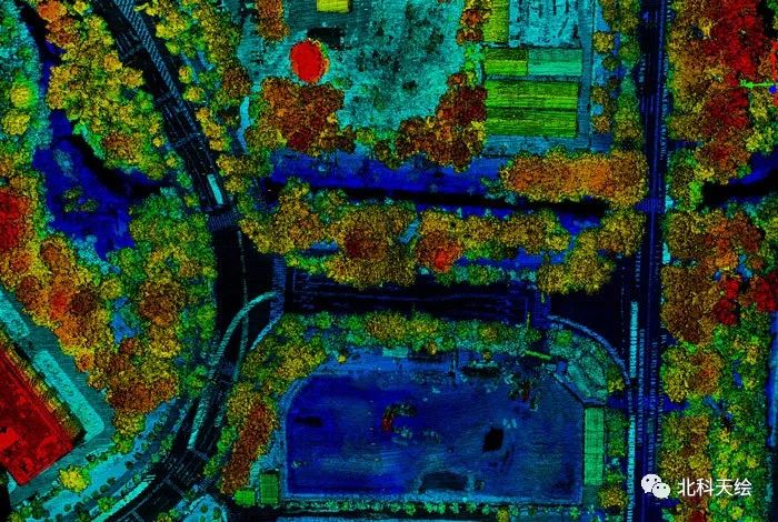
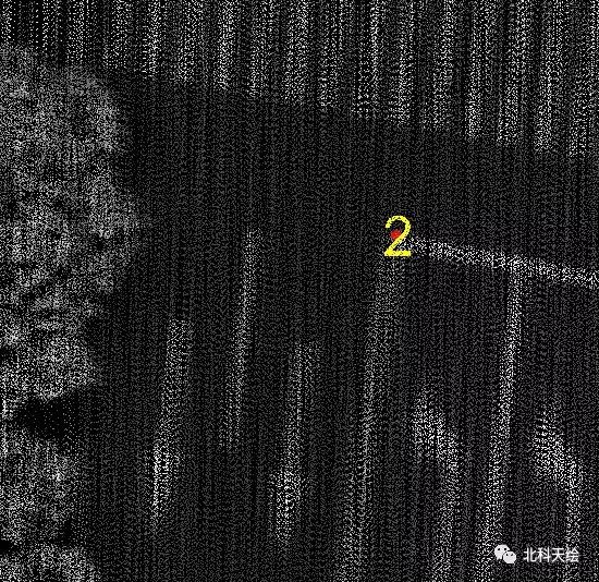
For example, according to the requirements of the flight project of the Guangdong Provincial Institute of Land and Resources Surveying and Mapping, the UTM-6 degree belt projection data in the WGS84 coordinate system is required. It is not difficult to see from the figure below that the road zebra crossings can be clearly distinguished, this is because the density of single flight belt points after the Genius test flight reaches 165per/m².
The point cloud grayscale elevation blend mode has a higher point density
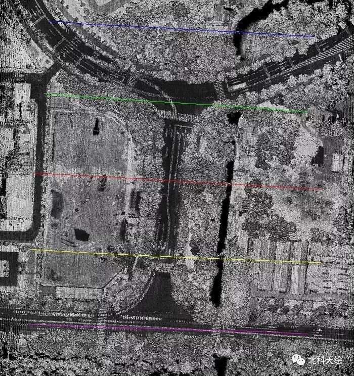
Different objects are clearly displayed after point cloud grayscale conversion
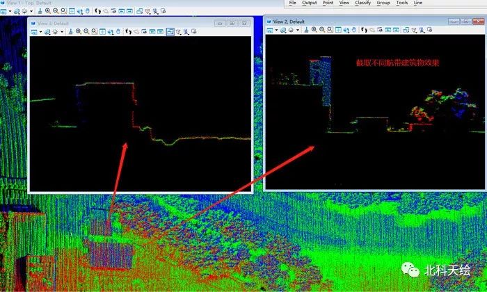
There is no layering phenomenon in the cross-section point cloud of buildings in different air strips
04
Coordinate transformation
According to customer requirements, technicians need to coordinate transformation of point cloud data, and convert WGS84-UTM projection to Gaussian projection in CGCS2000 coordinate system
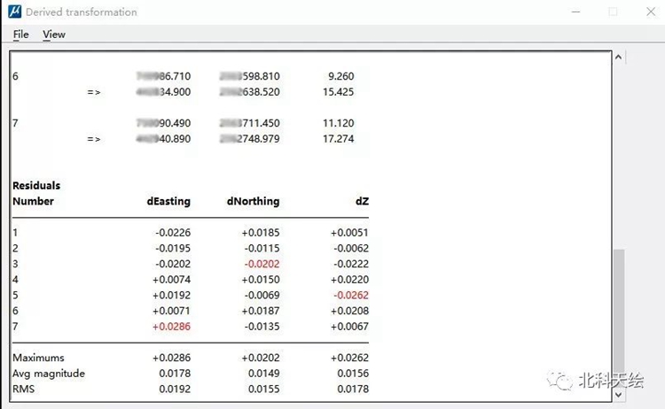
Accuracy report after Terrasolid coordinate transformation
Verify that the elevation accuracy data reaches 5cm after conversion
After the conversion, the lane lines are still clear, which meets the requirements of flying in the survey area
05
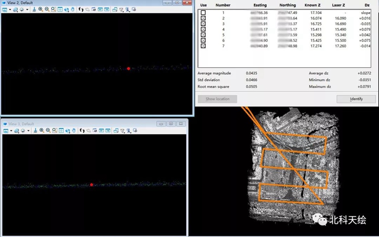
Verification of Elevation Accuracy of WGS84 Coordinate System
Whether the converted data is accurate or not, we will verify the elevation of the collection point through Terrasolid software, and obtain the following data:
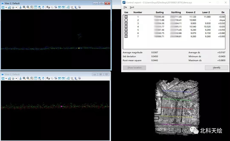
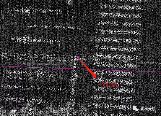
Verification point distribution
The customer's requirements include the measurement of the elevation data accuracy under the dual coordinate systems of WGS84 and CGCS2000, and the minimum root mean square data of the two verifications is only 4cm, which is obviously better than the 10cm system elevation accuracy value range in the parameter table. This pragmatic style Received unanimous praise from customers.
With its complete Chinese supporting software, the Genius micro-UAV LiDAR system reflects the outstanding advantages of agility and efficiency, strong multi-platform compatibility, and flexible operation methods. 1 set of batteries, it only takes more than 6 minutes to fly, the real single-soldier operation, which will undoubtedly set the top of the aerial survey efficiency!(www.isurestar.net)