Concept map of underground complex
As a major country in the development and utilization of underground space, China has always insisted on starting from the two directions of new addition and renovation to promote the development of underground space. During the "13th Five-Year Plan" period, my country's new underground space construction area reached 844 million square meters. In 2018, the ratio of the completed area of urban underground space buildings to ground buildings in the same period has reached more than 1:4. Underground operations are coming Hand-held surveying and mapping equipment, due to its portability, has entered people's field of vision very early. Light weight, small size, and fast operation, undoubtedly can well solve many typical problems encountered in underground scene surveying and mapping. Thanks to breakthroughs in miniaturization in recent years, handheld lidar, with its excellent detection performance and high resistance to environmental interference, has gradually emerged from various handheld portable surveying and mapping equipment and has won the favor of surveying and mapping people. . Not long ago, StarScan, a handheld 3D laser scanner independently developed by Surestar, was unveiled in an underground space reconstruction project in Guangxi.
Handheld 3D laser scanner-StarScan
The goal of the project to transform the space is a parking lot located in the basement of the office building, with an overall area of about 1500m². And it is still in normal operation during the surveying and mapping period. For more traditional site scanners, whether it is an internally parked vehicle, a series of equipment such as electric boxes, pipelines, and fire-fighting facilities, or the flow of traffic in and out, it will affect the efficiency of surveying and mapping operations and the accuracy of surveying and mapping results.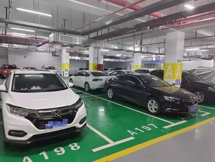
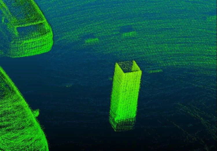
A corner of the work area
In order to complete the job accurately and efficiently, Surestar uses the fast collection time and high efficiency StarScan handheld scanner for the job, and after the point cloud data collection is completed, it is processed by AutoCad to achieve the customer's needs with quality and quantity. After on-site surveys, considering that the internal space structure of the parking lot is roughly divided into two parts by the stairwell, Surestar decided to divide the entire surveying and mapping area into two parts and adopt a closed loop operation method to ensure the best data collection effect Present. The surveying and mapping personnel first set the equipment to stand still in the work site, and then started the 3D information collection operation of the underground parking lot space by a steady walk, and took the method of stopping moving and scanning carefully for the more prominent feature points in the measurement area. The accuracy of data collection has been guaranteed.
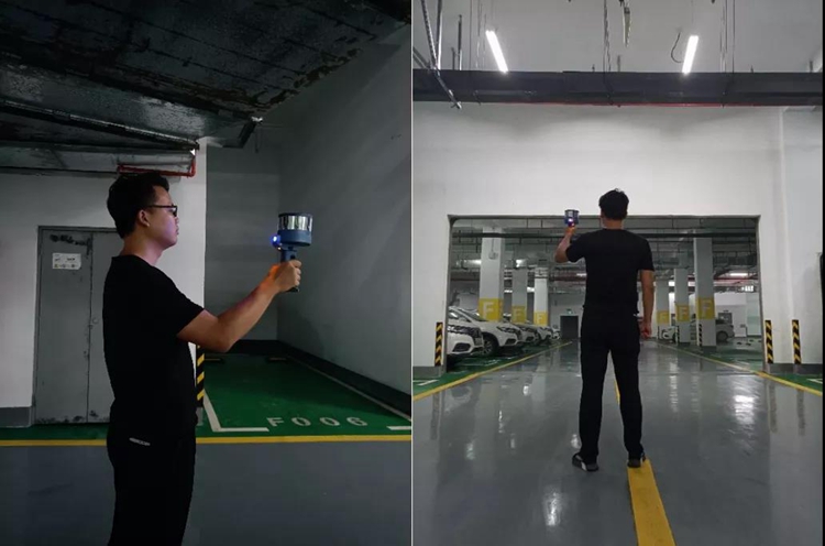
Surveying and mapping personnel carry out equipment standing and data collection work
A few minutes later, the surveying and mapping personnel returned to the position where the job started, and the data collection job was completed. The surveying and mapping personnel will then export the collected data and use the StarSolve software independently developed by Surestar for data calculation.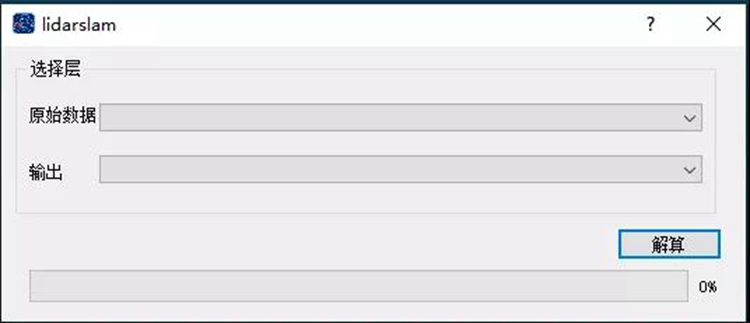
StarSolve solution data
The StarSolve software first denoises and trims the original point cloud data obtained by the scout, and removes the noise of the surveyor’s walking path and some ground object noise. And cut out the three-dimensional space information outside the boundary of the predetermined work area, make the point cloud data include and only include the internal environment of the parking lot.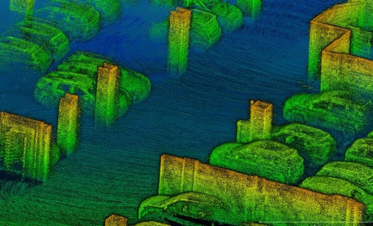
Point cloud A after denoising
Point cloud B after denoising
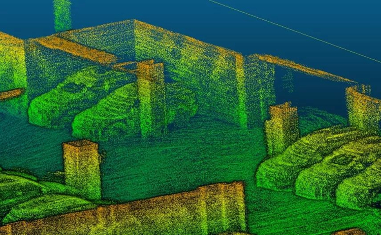
Next, through the matching of the collected features, the StarSolve software re-splices the two parts of the measured point clouds into a complete three-dimensional point cloud. For the matching points, the surveying and mapping personnel selected multiple feature points distributed in different directions throughout the work area to ensure that the models from the two point clouds can be better fitted, so as to achieve the optimal degree of fit.
Splicing point cloud error
Pillar blends well
After obtaining the complete three-dimensional point cloud of the underground parking lot, the surveying and mapping personnel checked the smoothness of the point cloud on the surface of each feature reflected by it, find out the redundant areas in the point cloud due to splicing and the noise of the point cloud on the surface of the ground object, perform cropping and denoising, and complete the processing of point cloud data.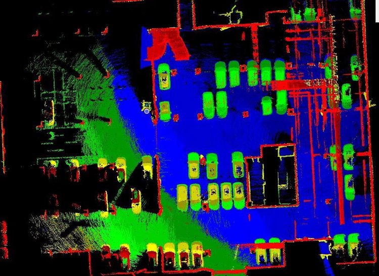
Point cloud before inspection
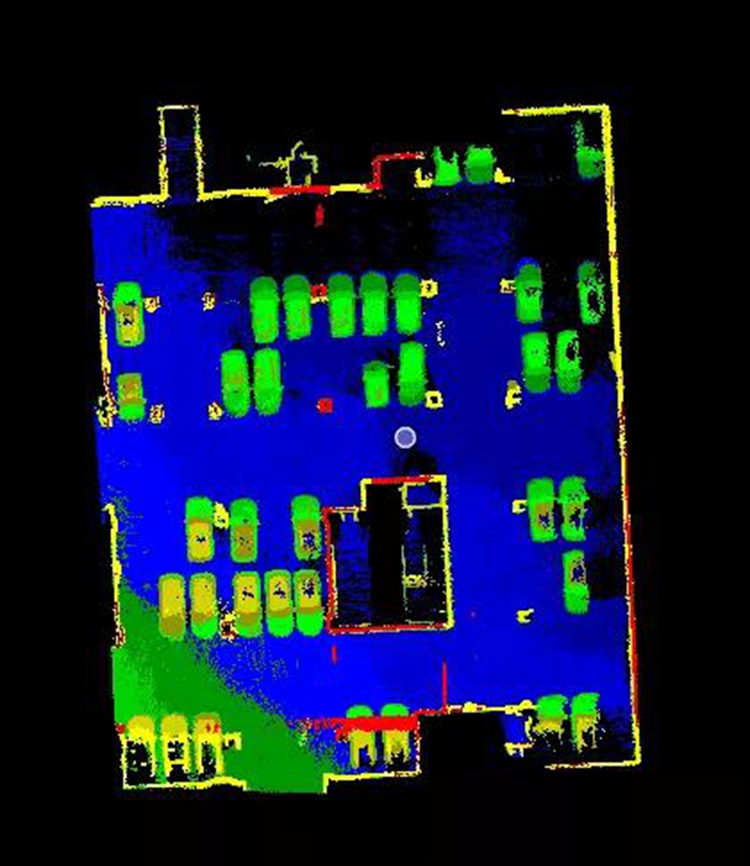
Point cloud after processing
Finally, the processed point cloud was imported into CAD to draw out the map, and the Autodesk Revit software was used to make a 1:1 three-dimensional model. The measurement of the entire underground parking lot took only one hour and forty minutes to complete successfully.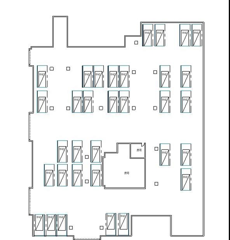
CAD drawing plan
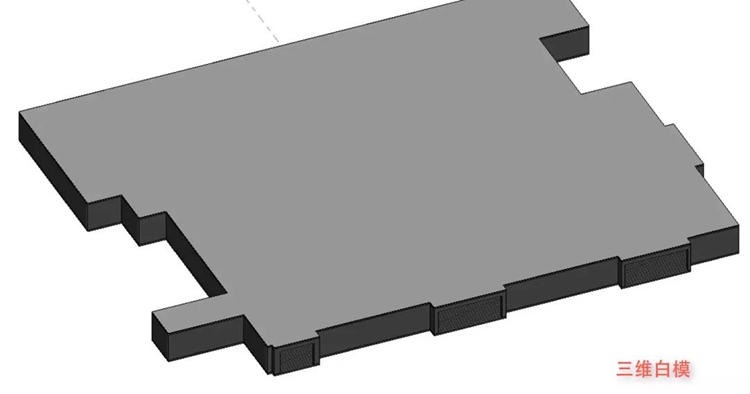
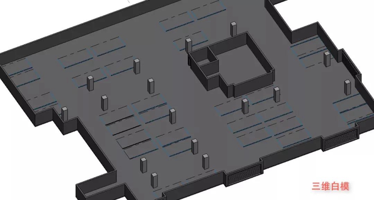
Three-dimensional white model of underground parking lot
In addition to convenience and efficiency, StarScan's measurement results are also very accurate. Through the comparison of the side length, beam and column size of the specific area of the parking lot, the maximum error between the CAD drawing generated by StarScan and the field manual measurement is only about 3cm, which is sufficient. Ground guarantees the availability of measurement data. StarScan proved the advantages of handheld lidar and Surestar's outstanding technical strength with actual results.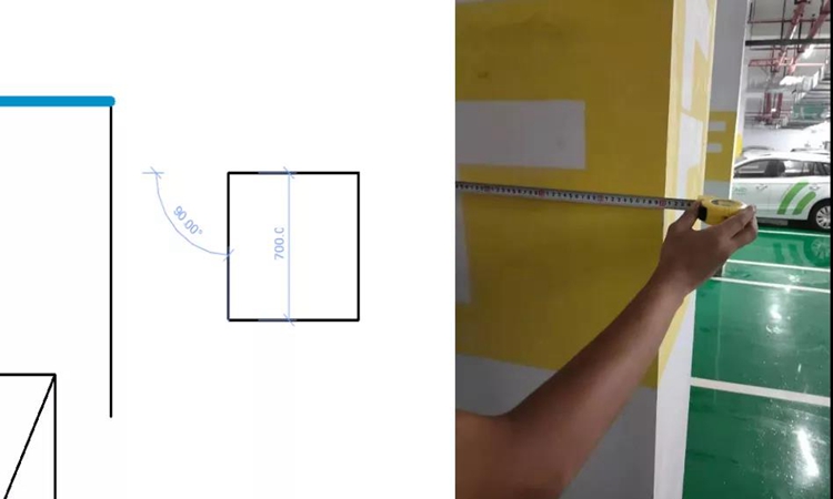
The measured side length of the beams and columns of the parking lot is almost the same as the data collected by StarScan
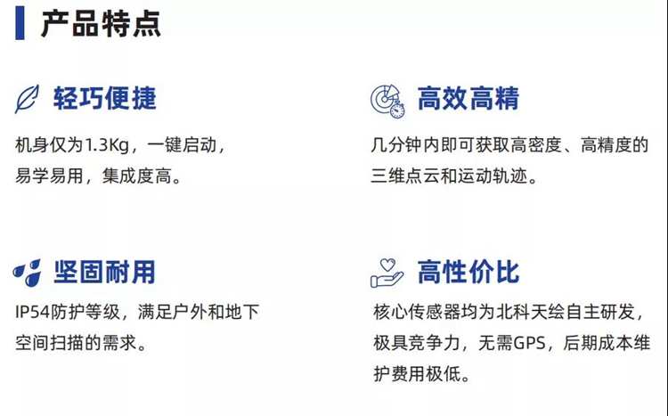
"Multiple questions, one solution" new star of all-round surveying and mapping The reason why StarScan can break through a series of obstacles in the underground surveying and mapping of traditional equipment, and complete the operation conveniently, efficiently and accurately is not only due to its natural super sensing ability as a lidar device, but also thanks to Surestar's reliance on The spiritual attainments in the field of lidar give StarScan many technical capabilities, making it the answer to "solving the last mile problem of laser scanning". As a lidar product, StarScan has a core range of 200m and an omni-directional field of view of 360°x30°, which enables it to complete data collection for a 5000m² operating area within 10 minutes. With its centimeter-level data accuracy and 320,000 dots per second scanning speed, StarScan can ensure accurate and comprehensive data collection while working efficiently.