
The application scale of lidar equipment in the construction industry is growing rapidly.
DroneDeploy, a U.S. drone software provider, mentioned in its "2021 UAV Industry Deployment Status Report" that 47% of UAV users in the construction industry said they were most interested in lidar functions. According to a report by North American construction engineering media ForConstructionPros: In 2021, 27% of construction industry companies will use lidar equipment in their projects for the first time.
The "explosion" of LiDAR products in the industry, Of course, there are construction companies that are driven by the continued impact of the new crown epidemic to reduce business costs. But more because of the outstanding effects of lidar in solving the pain points of the construction industry and meeting the needs of the project.
01
In the construction industry, surveying and mapping operations are inseparable from scenes such as new construction projects, quality management, maintenance, repair and renovation. Obtaining the basic information of the target building/region through surveying and mapping operations is a prerequisite for ensuring the safe and efficient progress of the construction process.
At this stage, the construction industry has demand for lidar, which is mainly concentrated in the following four perspectives:
As an enhancement and supplement to traditional surveying and mapping methods, lidar can rely on its ability to obtain high-precision three-dimensional point clouds to improve the efficiency and quality of engineering surveying and mapping operations.
Through the processing of high-precision three-dimensional point clouds by the supporting software, the construction party can quickly obtain the data results such as the two-dimensional line drawing of the building, and provide a reliable basis for the development of the construction plan.
Based on 3D point cloud data, lidar can accurately and quickly complete 3D modeling work that meets the specific requirements of the project. Help the construction unit analyze and master various factors in the construction process, such as the terrain visibility, earthwork statistics, etc.
With the support of 3D modeling, lidar measurement technology can realize expanded applications such as 3D simulation and virtual reality construction for a single building or an area. Simulate and demonstrate the project plan, so as to formulate a more reasonable construction plan.
The continuous expansion of the application scale of LiDAR in the construction industry stems from its ability to obtain high-precision three-dimensional point clouds, and further, because the powerful performance of LiDAR itself can better meet the needs of the industry.
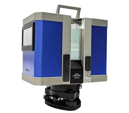
U-Arm Ground 3D Laser Scanner
Take Surestar's U-Arm ground 3D laser scanner with completely independent intellectual property rights as an example. This product has a longest range of 3600m, a range accuracy of 5-8mm@100m, and a scanning speed of up to one million points per second. And 0.001° angle measurement resolution. At the same time, U-Arm is equipped with UIUA software independently developed by Beike Tianhui, which can realize data collection, pre-processing, post-processing and other functions, and quickly provide customers with a variety of data results.
02
U-Arm, which has excellent surveying and mapping performance and diverse data results, has so far passed a large number of examples of different types of projects, proving its position as a leader in domestic mid-to-long range scanning systems.
In the facade renovation project of Xunyang Road Pedestrian Street in Jiujiang City, Jiangxi Province, the U-Arm 3D laser scanner has made outstanding contributions to the formulation of the construction plan.
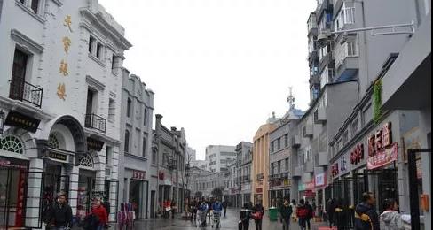
Xunyang Road Pedestrian Street
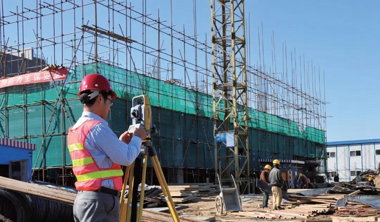
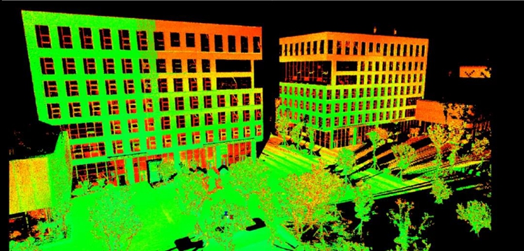
After completing the preparatory work such as surveying the survey area and arranging control points, the surveying and mapping personnel brought the U-Arm into the pedestrian street of Xunyang Road in the target survey area, carried out field scans, and collected point cloud data.
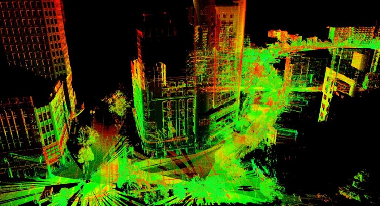
Raw point cloud data of pedestrian street
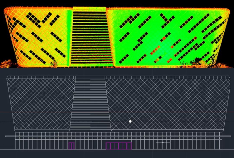
After the 3D point cloud is acquired, the project enters the data processing stage. Use UIUA software equipped with U-Arm to register and denoise the original point cloud data. And based on the processed point cloud, the street elevation drawing is completed.
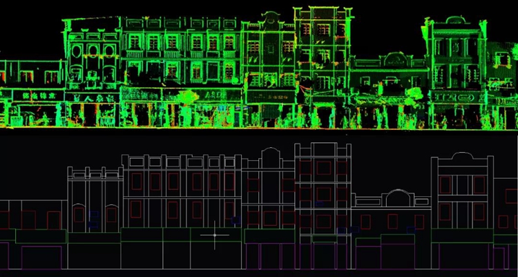
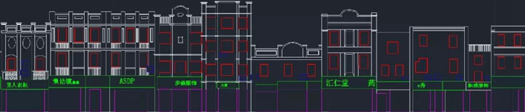
Pedestrian street elevation drawing
So far, U-Arm has efficiently and accurately completed the drawing of the building elevations on both sides of the road in the pedestrian block of 1 km long, providing an important reference for the planning of the construction plan.
In addition to surveying, mapping, and surveying for "own job", U-Arm has also demonstrated its outstanding strength in the extended application project of lidar surveying and mapping based on three-dimensional modeling.
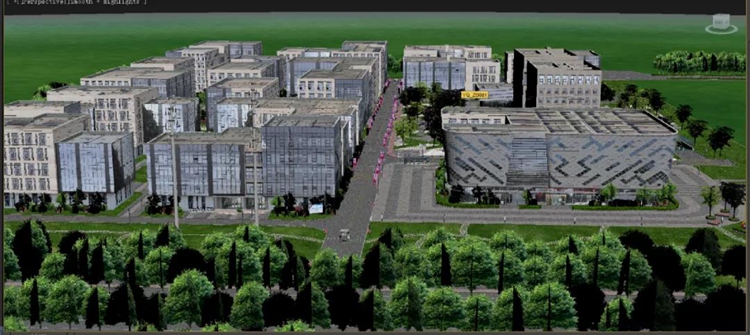
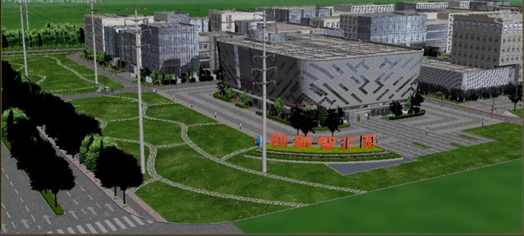
In August of this year, the 3D model and virtual reality project of the Zhihui Industrial Park in Baohe District, Hefei was completed with high efficiency and high quality under the support of the excellent performance and comprehensive capabilities of the U-Arm 3D laser scanner.

Zhihui Industrial Park, Baohe District, Hefei
Thanks to U-Arm's ultra-long distance measurement, after surveying the survey area and successfully arranging control points, the surveying and mapping personnel completed a global field scan of the Baohe Zhihui Industrial Park covering an area of approximately 180,000 square meters in just one day , The complete 3D point cloud data of the survey area has been collected.
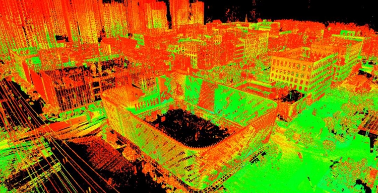
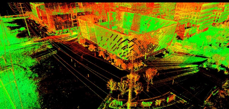
Park point cloud data
Through a series of subsequent processing such as denoising and classification of the point cloud data, the three-dimensional point data of the work area is obtained, and the high-precision data results of the survey area range are quickly output, and then it enters the internal processing stage.
Partial point cloud after denoising
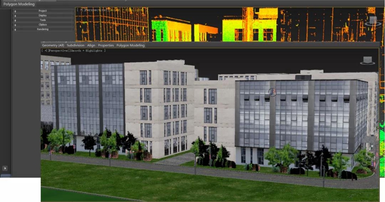
Use CAD software to draw the line drawing of the building, and extract the two-dimensional line drawing of the single building in the park.
Use 3DMax software to build a three-dimensional model, complete the three-dimensional modeling work of the park environment, and realize the construction of the overall three-dimensional model of the park.
In the above-mentioned projects, the U-Arm 3D laser scanner gave full play to the advantages of long measuring range and high precision, demonstrated excellent scanning effect and work efficiency, and delivered satisfactory answers to customers in projects with different needs.
As far as the construction industry is concerned, Lidar is not only a perfection of traditional surveying and mapping technology, but also a kind of development, making surveying and mapping work play a greater role in the construction process of construction projects.
U-Arm is such an excellent device with accurate perception, rich results, and diverse capabilities that not only makes the empowerment effect of lidar on the construction industry more significant and diverse. Backed by Beike Tianhui, which has independent development capabilities for high-end lidars of surveying, mapping and navigation, and complete product independent upgrade and maintenance capabilities, U-Arm also relies on its comprehensive and outstanding capabilities in topographic survey, engineering survey, and deformation. It has demonstrated its skills in many scenes such as monitoring and vegetation surveys, and has been widely used, and continues to shine in the endless new surveying and mapping scenes, bringing stability, accuracy and efficiency to every customer and every project.(www.isurestar.net)