
In order to maintain the normal work of electric lines, the power industry has to inspect the power lines in the jurisdiction every year. The traditional manual line inspection method is inefficient and it is extremely difficult to inspect various complex environments. Manual inspection has many limitations and dangers.
However, China's transmission lines are widely distributed, some of which are located in high mountains and inaccessible places, all of which pose severe challenges to the power inspection work.
●Current situation of inspection
01. Skylark lidar-new trend of inspection
With the maturity and popularization of lidar technology, more and more production units are aware of the advantages of laser point clouds, and the use of lidar for data collection has gradually become the mainstream.
However, there will also be some units that ignore performance and stability when choosing "lidar" products, resulting in sparse power line point clouds, disconnections, low point density, incomplete towers, etc. Therefore, choosing a laser radar product with good performance and stability has become a topic that cannot be bypassed to improve industrial efficiency.
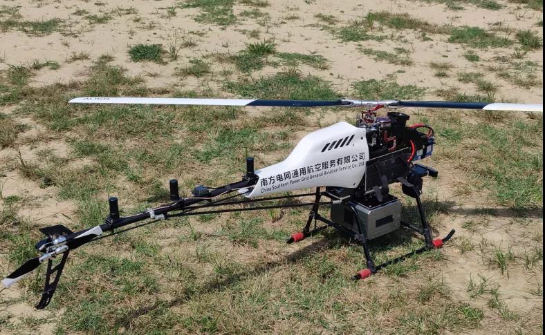
Figure 1 China Southern Power Grid Unmanned Helicopter + Skylark Lidar
02. Solution equipment-Surestar Skylark
The Skylark lidar system consists of AK-1500 lidar, combined inertial navigation system, digital camera and power supply. The size adaptability is high, the weight of the whole system is about 3.5 kg-5.5 kg, so it is suitable for most flight platforms.
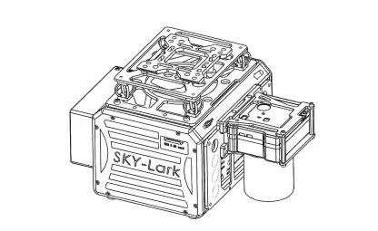
The Lark Lidar system has the characteristics of fast data acquisition, high measurement accuracy, and long detection distance. It is a miniature airborne lidar equipment developed for the needs of China's mountainous landforms and efficient aerial survey operations. It can be widely used in urban three-dimensional and electric power Line inspection, island and reef survey, forestry census, cadastral survey, deformation monitoring and water conservancy survey, disaster assessment and other fields that require agile, efficient and high-precision three-dimensional survey.
Main features of the equipment:
1.70°×40° scanning field of view coverage, spiral scanning
2. Built-in GPS receiver, can be flexibly configured with 1 or 2 GPS antennas
3. Configure the IMU interface module, you can configure the IMU according to the system solution needs
4. Built-in SD card storage, flexible setting of flight routes and storage of lidar operation data
5. High size adaptability, light weight, suitable for multiple UAV platforms such as multi-rotor and vertical fixed wing
6. Flexible system integration capabilities, high system integration, simple software and hardware operations
7. Open software interface, users can carry out secondary development according to their own needs
03. Flight data comparison
This flight also selected a section of transmission line as the test comparison, focusing on the point density per square meter, the tower power line, and the integrity of the insulator string.
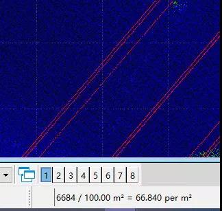
Figure 2 the peers of lidar: point density <70 per m²
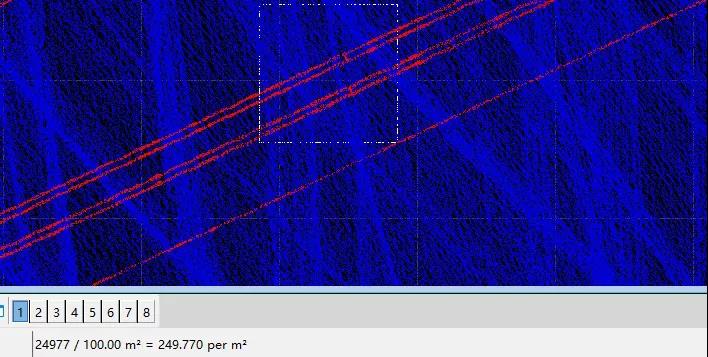
Figure 3 Skylark: Point density>240 per m²
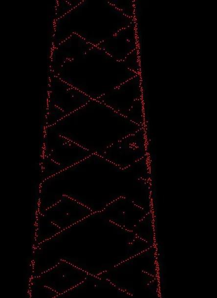
Figure 4 the peers of lidar: sparse point cloud of power line towers
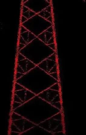
Figure 5 Skylark: The power line tower is complete and the outline is clear
➡️Live flight
The test line is a 500kV transmission line, on-site flight and calculation data. Focus on point density, integrity of electrical towers, power lines, and insulator strings.
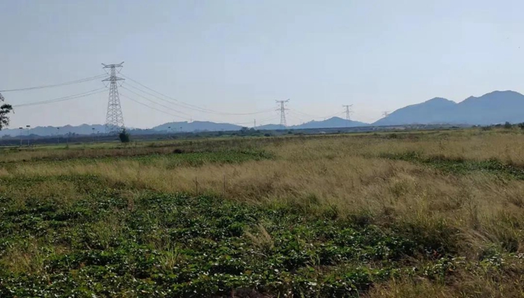
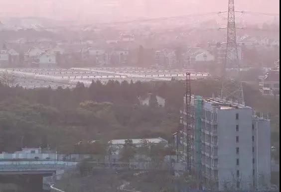
Figure 6 Survey area environment
➡️Operation process
1. Set up a static base station with a static collection frequency of 1Hz/2Hz, receive GPS, Beidou and Galileo satellite systems, and start the device at least 5 minutes before it is turned on.
2. Adapt the equipment to the unmanned helicopter.
3. Route planning, which is set according to the actual situation of the survey area. Then power on the device and let it stand for 5 minutes. The system includes an inertial navigation system, so it needs to stand still for 5 minutes before taking off to make the inertial navigation system reach a good working condition.
4. Automatically fly according to the set route equipment.
5. After the flight is completed, stand on the ground for 5 minutes.
6. End the data collection of the ground static reference station for at least 5 minutes.
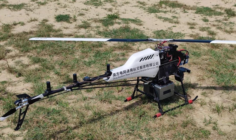
Figure 7 Photos of field operations
➡️ Data results
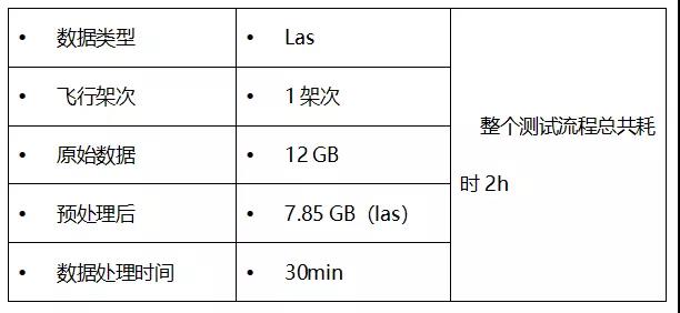
Figure 8 Original point cloud of 500kv power line
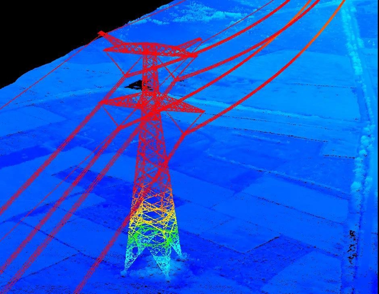
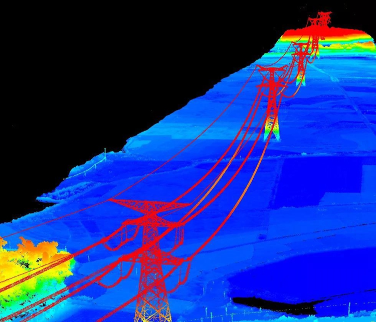
Figure 9 Original point cloud of power lines and towers
Rich in details:
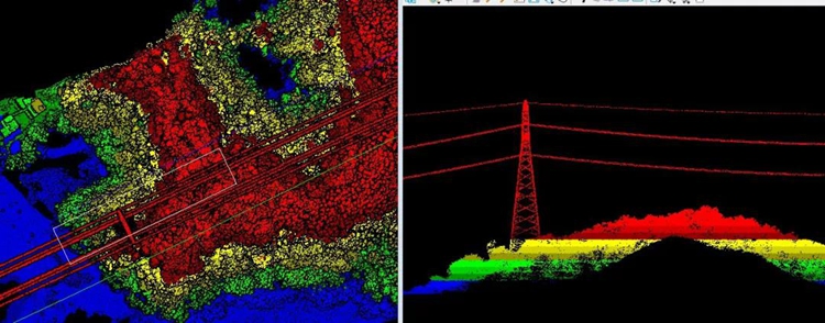
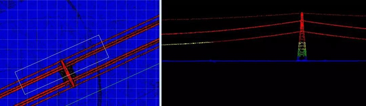
Figure 10 Wire details: The wire is continuous
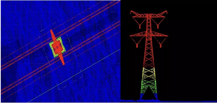
Figure 11 The insulator string is clear and the details are complete
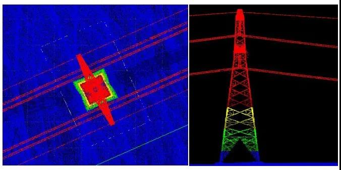
Figure 12 The pole tower is clear and the details are complete
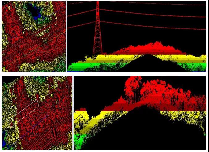
Figure 13 Multi-echo penetration effect, dense vegetation can still obtain a large number of ground points
Point density:
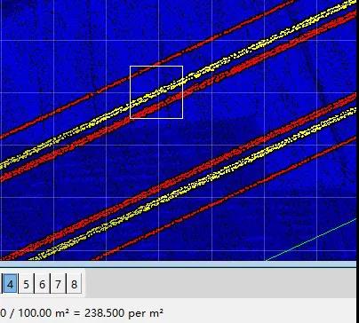
Figure 14 Dot density: Dot density>238pts/m², to meet customer requirements for high dot density