
Lidar can not only help us grasp reality, predict the future, but even go back to history.
The application range and coverage scenarios of lidar are getting wider and wider, constantly breaking people's cognitive boundaries. However, can you imagine what kind of sparks can burst from the combination of LiDAR and archaeology?
Especially in recent years, benefiting from the evolution of product performance, lidar has quickly become one of the most influential "new tools" in archaeology. Especially in the measurement and restoration scenes of ancient buildings, the appearance rate of lidar is getting higher and higher. The mystery that often requires manual surveys and surveys for months to be revealed to the world, lidar can be realized in just a few hours of operation.
Lidar and ancient architecture, two concepts that are so far apart, why do they spark a dazzling cross-border spark? Today, let Xiaohui take you to find out.
01
In the field of surveying and surveying ancient buildings, archaeologists face two difficulties: one is the surrounding environment, and the other is the building itself.
Many ancient architectural sites are located off the beaten track, often because of inconvenient transportation or even no way to go. Not only is it difficult to reach the site of the ruins, but the road is often surrounded by dangers, and for locations where the precise location cannot be determined, archaeologists used to search and search by foot, which was time-consuming and laborious.
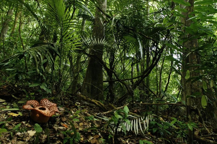
In search of monuments in the rainforest off the beaten track, archaeologists not only have limited vision, but also have difficulty walking
More than that, after finding and arriving at the place where the historic site is located, environmental factors will still hinder the survey and survey of ancient buildings. A very typical example is the dense forest. Because there has been no large-scale human activities for hundreds or even more than a thousand years, the vegetation around the site is very lush. Conventional hand-operated instrument surveys, aerial photography and other technical methods will be blocked by vegetation. The quality of the measurement results is greatly compromised.
Even in environments where there are no vegetation-influencing factors such as deserts and Gobi, the survey and survey of ancient buildings will face many problems from the building itself. Especially in the two scenes of measuring the surface of ancient buildings with a certain height and measuring the interior space of the monuments that are still accessible.
Whether it is climbing high or working deep inside the historical site, archaeologists will not only greatly increase their own risk factor, but may also cause irreversible damage and damage to the inherently fragile ancient building structure.
02
The main reason why lidar can be favored by the archaeological community is that it can help archaeologists solve these problems.
The first is the issue of capacity and survey efficiency. The surveying and mapping lidar system that can only be installed on fixed-wing aircraft or helicopters can now be carried on light drones.
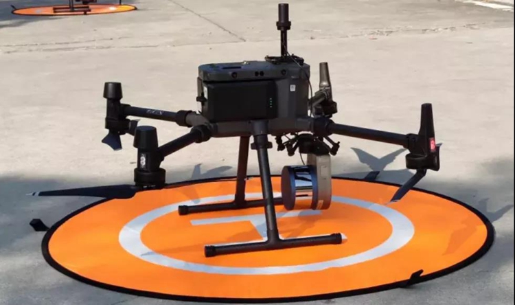
Surestar's "Genius" micro-UAV-borne lidar system, the scanner weighs only 738g, and the system with a high-definition camera weighs less than 2kg. The operator can easily carry the "Genius" to go deep into the jungle and Gobi.
The UAV-borne lidar is less affected by the ground environment and climatic factors, has low requirements for restricted take-off and landing conditions, and is flexible and efficient in operation.
Another airborne LiDAR under Surestar's "Wind Butterfly" has a maximum operating height of 200m and an effective point density of 200/m² for a single flight belt. The coverage area of a single operation can even reach as high as 6km², which can significantly improve the efficiency of ancient building surveys.

In terms of measurement effects, the centimeter-level ranging accuracy of "Genius" and "Wind Butterfly" can ensure the accuracy of measurement results. At the same time, LiDAR is the one of the existing remote sensing technologies that is least affected by vegetation. High-frequency lasers can Measure the terrain covered by vegetation. General lidar processing software can classify, filter or remove point clouds incident on non-targets such as vegetation through automatic or manual interactive processing.
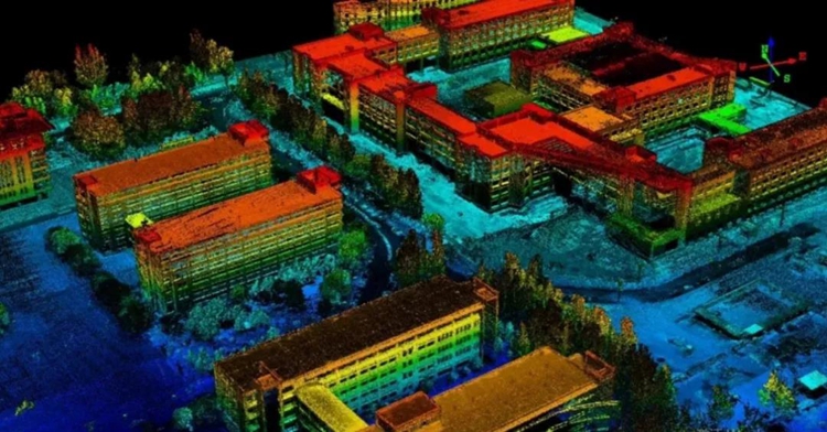
Genius high-precision 3D point cloud effect
During the whole process of the measurement operation, the lidar does not need to contact the target building body, which can well maintain the status quo of the ancient building and avoid personnel danger and damage to the historic site.
In addition, another form of lidar equipment other than airborne-a handheld 3D laser scanner, in difficult scenes such as the surveying and mapping of exterior facades of tall ancient buildings and the measurement of interior spaces of historical sites, it can well solve the pain points of operation.
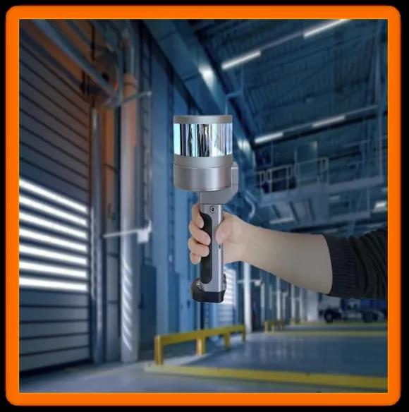
Take the hand-held lidar "StarScan" independently developed by Surestar as an example. It can be operated by a single person and is in a hand-held form. It naturally has the convenience of indoor space measurement. At the same time, "StarScan" also has an inclination measurement mode. Even with power poles tens of meters high, surveying and mapping personnel can complete operations on the ground, not to mention multi-storey ancient buildings hundreds of years ago.
03
From the perspective of parameters, or theoretically speaking, Lidar plays an irreplaceable important role for archaeology, especially the survey and repair activities related to ancient buildings. In fact, LiDAR has also shown sufficient performance to prove that the theoretical advantages of LiDAR equipment can be fully utilized in reality with "high fidelity".
In 2020, in a report in the journal Nature, the National Geographic Institute of Mexico and the University of Arizona, through aerial lidar surveys, discovered a field consisting of at least 478 ancient animals in a wilderness about 850 miles east of Mexico City. The Mayan cultural complex composed of architectural relics provides a large amount of archaeological basis for the academic research on Mayan civilization.
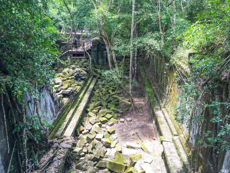
Turning their eyes to Asia, in a documentary about ancient Khmer civilization broadcast on Discovery Channel, archaeologists used the Surestar "Genius" micro drone-borne lidar system in the rainforest of Cambodia to test a Khmer ancient civilization. The temple has been surveyed and mapped, and accurate and detailed data results have been obtained. The archaeologists who participated in this historic site surveying and mapping operation praised: "Genius" helped us complete a very challenging task!

The high recognition of lidar has become a consensus in the archaeological community. Fowler, associate professor of archaeology at St Mary’s University in Halifax, Canada, said: “Airborne lidar has become a powerful tool for archaeologists to tell historical stories, and it also provides us with more historical information.”
Professor Fowler used the airborne lidar to detect Canada’s first national historic site-Fort Anne and obtained relevant geographic data. Combined with the historical map of Fort Anne in the French National Archives, a 3D model of Fort Anne that "the smallest detail must appear" was created.
Application in the field of archaeology to help us trace back the historical silhouette is just a microcosm of the role of lidar. For "reality" and "future" lidars are also constantly glowing.
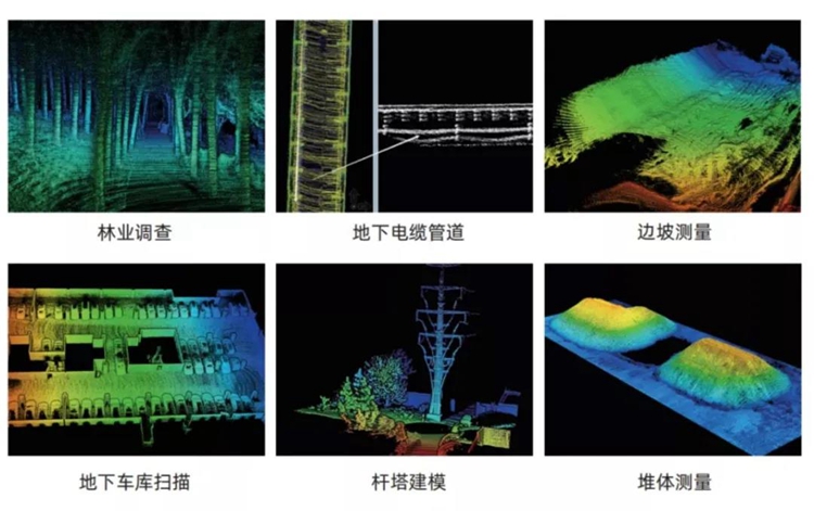
In addition to the most widely known areas of autonomous driving and geographic surveying and mapping. Lidar has been widely used in industries such as infrastructure construction, municipal gardens, electric power and water conservancy, and even agriculture.
Looking to the future, not only is the handheld lidar, because it can adapt to the needs of operations in almost all scenarios, it has become the "key" for people to explore the digital twin scene. The LiDAR family composed of various types of lidar equipment is also due to its The indispensability of the high-fidelity and high-frequency updated real-world model has become an indispensable sensor with infrastructure properties in the process of constructing the meta-universe.
With the unremitting efforts of many lidar manufacturers at home and abroad, lidar has never stopped its evolutionary road, and now its application range is even more "through the past and the present, looking to the future." As the world's leading lidar manufacturer, Surestar continues to move towards a prosperous future in the industry, and will continue to persist in research and development and exploration, so that the high-frequency laser of lidar can repeatedly penetrate the barriers of industries and fields. Always move towards the goal of "blooming in the dimension of the whole society".(www.isurestar.net)