
I believe that you who care about science and technology and surveying and mapping fields must have been filled with the word "lidar" recently.
"Vehicle-level 256-line solid-state lidar is launched", "Autonomous driving models equipped with lidar are mass-produced", "a major manufacturer releases a'price butcher' declaration for the pre-installed LiDAR market"... about the importance of lidar The news is endless.
LiDAR is getting more and more attention, but most people who eat melon do not have a comprehensive understanding of LiDAR. In fact, in addition to the most familiar and most discussed car navigation LiDAR, there are also "flying in the sky" airborne LiDAR and The "hand holding" holds LiDAR.
Xiaohui will take everyone in this article to take a look at the various forms of lidar and how they perform under the continuous evolution of product performance and repeated expansion of application scenarios.
Lidar is the best choice for surveying and mapping equipment
Among the three main forms of lidar products today, "flying in the sky" airborne lidar has the longest history. In the late 1980s and early 1990s, the University of Stuttgart in Germany combined laser scanning technology with GPS and inertial positioning systems to develop the world’s first airborne laser scanner-Ackermann-19. This opened up the glorious "Road to the King" of airborne lidar so far.
Beginning in 1995, airborne lidar began to be commercialized. Compared with traditional aerial surveys that rely on cameras, cameras, remote sensors and other equipment, lidar has the advantages of high original point density, high elevation accuracy, and strong vegetation penetration.
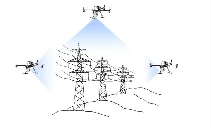
Airborne LiDAR can survey and map the target area from the "God's perspective"
In addition, due to the “active measurement” that emits and receives high-frequency lasers, compared to traditional aerial surveys, airborne lidars are minimally restricted by weather conditions. With the support of 3D point cloud modeling, airborne lidar can complete surveying and mapping operations truly and accurately without field image control point measurement, and can efficiently carry out long-distance and large-area operations, becoming the best choice in topographic surveying and other fields.
Over the past thirty years, the airborne lidar has not been "pushed down on the throne" by latecomers, but has continued to evolve under the continuous evolution of technology. Take the Fengdie magic pro released by Surestar in April this year: this product with a weight of less than 1.25kg is positioned at the beginning of the design as a "powerful, 360° micro airborne LiDAR with no short board". Fengdie has an elevation accuracy of 5cm, a maximum operating height of 200m, and an effective point density of 200/m² for a single flight belt. The measurement area for a single flight has reached 6km².
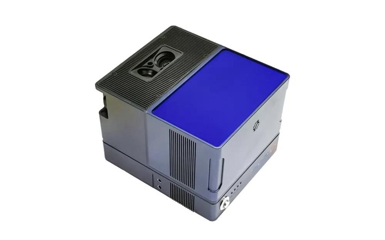
Fengdie magic pro (dual camera version) micro-UAV-borne lidar
While continuously making breakthroughs in performance, the application range of airborne lidar has also expanded. Nowadays, it is indispensable in many fields such as electric power inspection, agriculture and forestry investigation, water conservancy survey, mine survey, etc., and it continues to penetrate into more fields. The airborne lidar, which has been constantly evolving over time, is enough to be called the "king" of surveying and mapping equipment.
Airborne lidar is booming
Like airborne lidars, "on the ground" vehicle lidars were also initially used to survey and map directions. The combination of lidar + ground vehicles moved the most primitive site-type lidar in form, which greatly improved the efficiency of ground survey operations at that time.
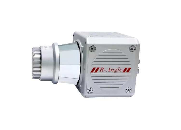
R-Angle Mobile 3D Laser Scanner
Although LiDAR products for vehicle surveying and mapping still have considerable room for survival in the market, we now refer to vehicle lidar, and more often they refer to vehicle navigation lidar.
Because of its efficient and accurate sensing capabilities, lidar is known as the "eye of autonomous driving." Benefiting from the fact that lidar has continuously broken the shackles that have plagued and hindered the development of lidar in the past, such as high price, large size, and difficulty in mass production in recent years, lidar has been widely recognized by the industry as an essential core sensor for high-end autonomous vehicles.
The huge development potential of autonomous driving makes players on and off the track all ready to move. In the increasingly fierce “arms race” of auto companies on autonomous driving, lidar has ushered in an unprecedented development opportunity. For a time, the car navigation LiDAR track can be said to be in full swing. At the beginning of 2021, LiDAR concept stocks will collectively strengthen, and many LiDAR manufacturers at home and abroad have also come up with their own new car-level products.
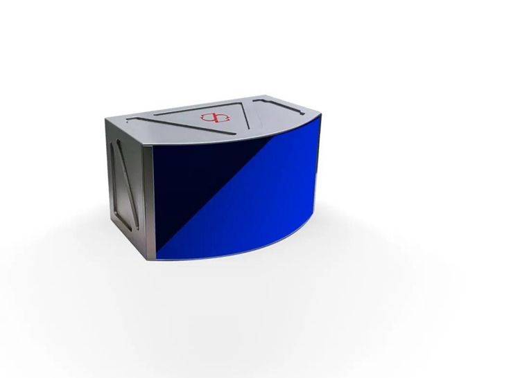
Image-level ultra-high resolution solid-state lidar-C-Fans-256
For example, the domestic lidar manufacturer Surestar, its C-Fans series products are the first front-mounted lidars with a complete car-scale design in China. C-Fans series products adopt chips and semiconductor technology with independent intellectual property rights, and have outstanding features such as low cost, high reliability, low delay, high resolution, and large field of view. In this series, C-Fans-256 is the world's first automotive-grade 256-line solid-state lidar, and another product, C-Fans-32, is currently the only lidar product that has passed “intrinsically safe” certification.
Handheld Lidar is the star of the future
If it is said that flying in the sky is "forever youth" and running on the ground is "prospering", then the "hand-held" handheld lidar is the absolute "star of the future" in the entire lidar category.
The enthusiasm of hand-held LiDAR subdivision tracks has begun to emerge. Surestar has been deeply involved in the field of lidar for many years, and established strong manufacturers with deep accumulation in the field of airborne and vehicle lidar have successively released self-developed handheld lidar products. . New industrial vision equipment manufacturers and lidar manufacturers have also laid out here one after another. As a relatively new segment of the battlefield in LiDAR, the fierce battle in the handheld LiDAR market is about to start.
At the moment when the real three-dimensional digital twin scene is extremely rich, the complexity of the surveying, mapping and scanning operating environment has greatly increased. People find that more and more sites cannot be accessed by vehicle-mounted surveying and mapping LiDAR. Faced with underground and three-dimensional work areas, airborne LiDAR with a "God's perspective" is not a panacea.
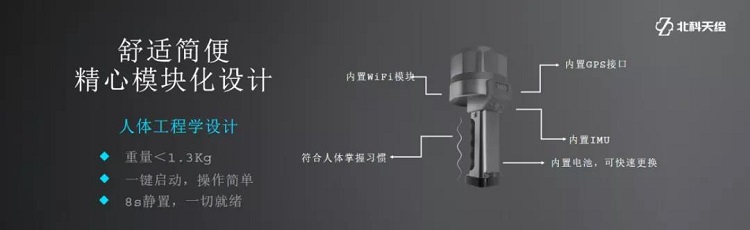
The biggest and most prominent feature of handheld LiDAR equipment is its portability. Take the “StarScan” independently developed by Surestar as an example. This handheld 3D laser scanner weighs only 1.3kg and can easily enter almost all work sites. .
In scenarios such as forestry investigation, underground space scanning, field environmental facility modeling, volume measurement, etc., the "StarScan" can enter the field smoothly with its small figure, so that the excellent sensing and measurement performance of lidar can be fully utilized, economically and efficiently. Complete surveying and mapping operations economically and efficiently.
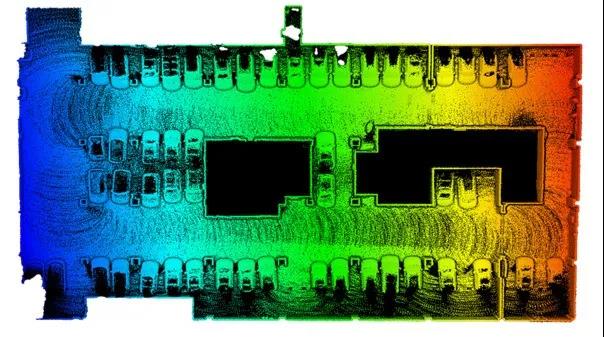
"StarScan" handheld LiDAR-underground garage point cloud image
For example, in small-scale power surveying and mapping operations or power supplementary survey scenarios, UAVs are susceptible to strong winds and require a relatively stable weather environment to successfully conduct surveying and mapping operations. In terms of cost, small-scale operations are not worth re-flying with drones. The use of airborne LiDAR for the above operations will undoubtedly lead to increased operating costs and waste of manpower.
However, in this situation, the "StarScan" is very handy. The handheld LiDAR is not only less affected by the weather environment, but also simple to operate. A single person can complete surveying and mapping. Not only greatly improves the flexibility of small-scale operations, but also significantly reduces the cost of repeated operations.
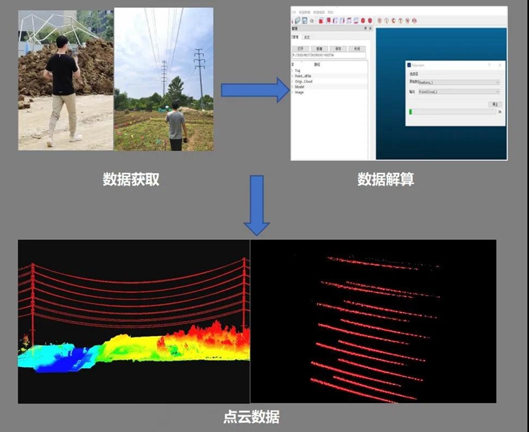
"StarScan" single person efficiently conducts small-scale electric power surveying and mapping operations
In the volume measurement link that is indispensable in infrastructure projects, the performance of "StarScan" is also very eye-catching. Take the measurement of piles as an example: "StarScan" can quickly based on the point cloud of the detected target without absolute coordinates. Directly establish the DSM (digital surface model) of the detection target, and obtain the volume of the pile by comparing the target DSM with the starting surface (base surface).
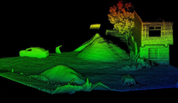
"StarScan" handheld LiDAR- 3D point cloud images of the stack and surrounding environment
And in the process of obtaining the target point cloud, the "StarScan" does not need target orientation or GPS-assisted positioning. The original collected data can be resolved and registered through the point cloud processing software to obtain high-precision registration point cloud data.
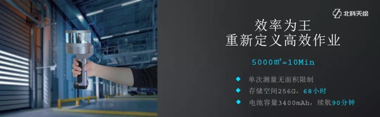
In addition, thanks to the ergonomic design of the “StarScan”and the 90-minute duration of a single operation, the easy-to-operate and small “scout” can help surveying and mapping personnel realize the real "light equipment"--You can measure wherever you go.
Hand-held LiDAR inherits the consistent high performance of lidar products. At the perceptual level, the 200m core 3D ranging and centimeter-level data accuracy of the "StarScan", combined with its scanning speed of 320,000 points per second and omni-directional field of view, can Perform 3D scanning of 5000m² within 10 minutes, and complete the modeling of high-precision collected data and other processing.
Nowadays, the application scenarios of 3D scanning have already broken through the scope of topographic surveying and industrial surveying. Underground space construction and completion acceptance, high-rise building maintenance and demolition, garden and municipal administration, construction project volume measurement and other tasks are inseparable from lidar equipment.
It is only a matter of time before such small, portable and high-performance handheld lidar products like "StarScan" become popular. The future hand-held LiDAR subdivision track will also, like its two "predecessors", usher in long-term rapid growth.
Although it seems that even in the past two years, the market size of handheld LiDAR can hardly grow to the size of the airborne or vehicle-mounted LiDAR track, but in the unstoppable digital flood of the whole society, the real-life 3D digital twin scene will eventually expand Covering all the details of society, the application scenarios and scope of hand-held LiDAR can even be equivalent to "the whole society" in theory, and it will become an extremely shining LiDAR star in the future.(www.isurestar.net)