
"StarScan" earthwork survey
Our products have been successfully applied in the scenarios of earthwork measurement, stone pile, and mine pile measurement for many times. Now at the measurement point of this project, it has been verified that the product can meet the needs of COVRE customers.

"StarScan" is a portable handheld 3D laser scanner independently developed by Surestar. The scanning speed of 320,000 points per second can collect more scene information and model the data. Combining LiDAR and Simultaneous Localization and Mapping (SLAM) technology, It is easy to use even in small spaces, and can achieve centimeter-level data accuracy without GPS signal.
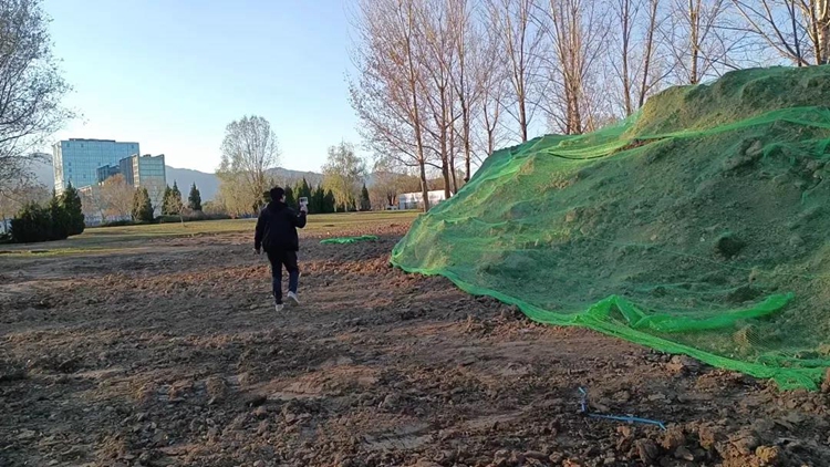
In this case, multiple "closed-loop" line scanning methods are used to scan around the target stack.
The collected raw data is solved in StarSolve and output standard format *.las point cloud data. Then, the point cloud post-processing software CloudCompare is used for cropping, filtering, splicing, 3D model making, volume calculation and output volume report.
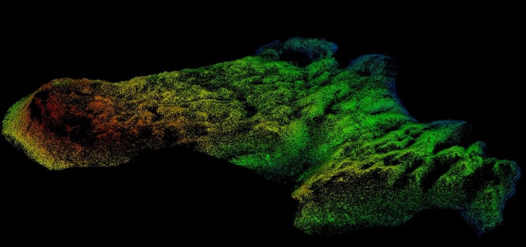
Heap point cloud
For the completed point cloud, extract the heap boundary and heap surface model, then calculate the volume, and quickly output the report.
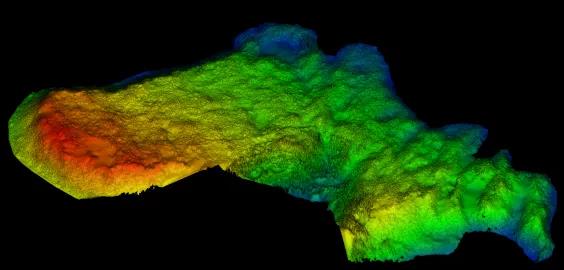
Heap model
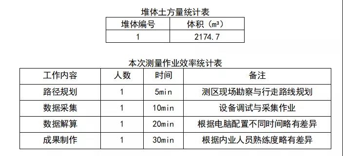
Using "StarScan" product for earthwork measurement not only has high point density, high precision, and obvious detail texture, but also can greatly improve the efficiency of field operations. The post-processing results only need to be modeled based on the point cloud data, and only one operator can complete the job requirements throughout the process.(www.isurestar.net)