

SureStar Launches Mini LiDAR System with Trimble APX UAV from Applanix
The Genius drone LiDAR system combines SureStar's UAV-based LiDAR sensor with Applanix' APX OEM module, for a lightweight UAV mapping solution built to achieve the perfect balance of weight, cost, and performance.
In 2017 it became clear that the airborne mapping and surveying industry was moving towards LiDAR sensors onboard UAVs; these solutions are very cost-effective for highly accurate and fast terrain data gathering. LiDAR has a number of advantages – including the capability to penetrate vegetation cover and provide real-time data – making it the preferred solution for users who regularly perform corridor mapping, and the mapping of hard-to-access areas.
SureStar, a leading LiDAR manufacturer for both mapping and autonomous vehicle LiDAR sensors, began developing a UAV LiDAR project back in 2016 and has now developed a UAV-based LiDAR sensor.
However, there are considerable challenges associated with UAV LiDAR systems, including potential financial losses associated with: UAV crashes, flight-time limitations due to heavy payloads, and poor point cloud quality. Applanix and SureStar began to work together in 2018 on the Genius drone LiDAR system, in order to provide a viable solution. The Genius drone LiDAR system has been designed and built to achieve the perfect balance of weight, cost and performance.
Solution
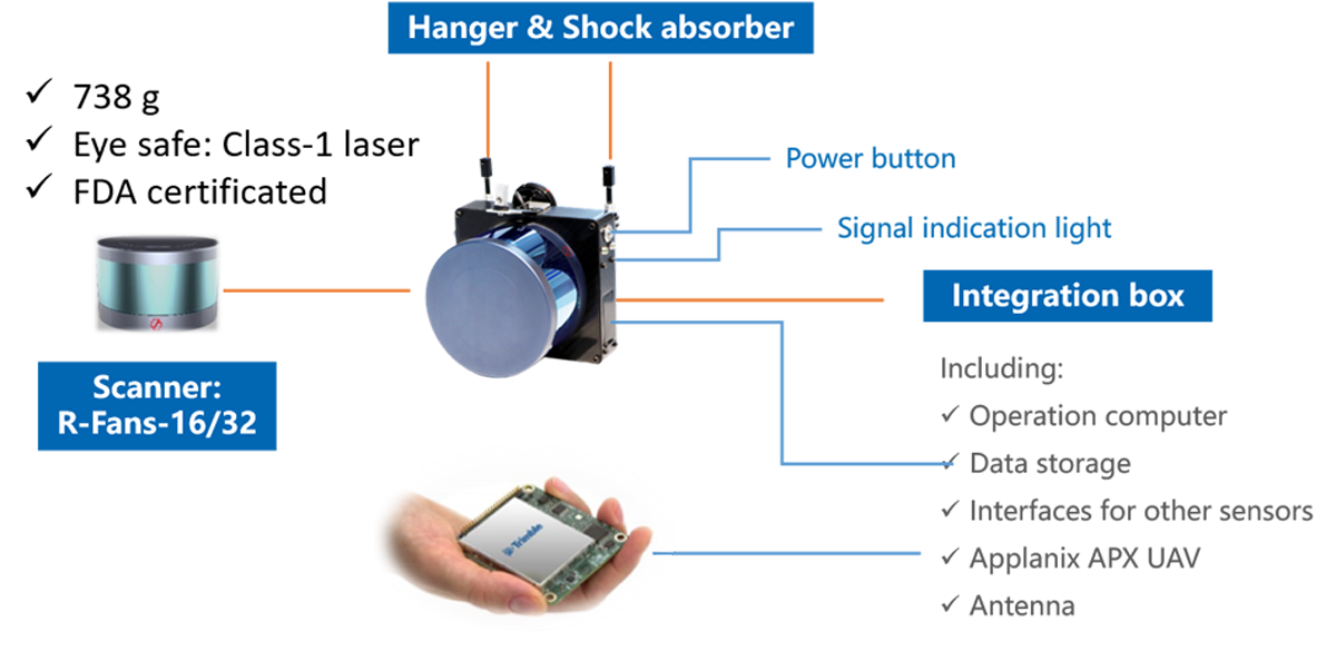
The Trimble APX UAV GNSS-Inertial solution is a complete hardware and software solution suitable for even the smallest of UAVs. It is comprised of a single-board OEM module (6*6.7 cm, 60 grams), which contains a survey-grade multi-frequency GNSS receiver and high-performance MEMS inertial sensors. Also included is Applanix’ POSPac UAV software for post-processing the collected data.
SureStar R-Fans laser scanner weighs only 738 g, yet is able to detect objects with 10% reflectivity at 200 m. UI-RF software comes with the R-Fans scanner to enable data fusion of flight trajectory and point cloud output in LAS or xyzi format, as well as point cloud visualization.
Together, these integrated products offer a lightweight solution which enables those mapping or surveying with a UAV to produce high-quality deliverables quickly and efficiently.
Combined Strengths of Applanix and SureStar
The Genius drone LiDAR system weighs only 1168 grams, meaning that it can be installed on even very light-weight drones.
Genius is able to:
Raplidly collect accurate 3D data, even in remote areas
Eliminate the need for Ground Control Points
Penetrate vegetation with 2 echoes
Support one-button start system operation
Monitor working status of the system in real-time
Review point clouds in real-time
Support continuous data acquisition and processing with an on-board computer
Complete data collection and processing with only one engineer
Key Features of Genius:
Range of 250 m for support flying at 150 m AGL
1168 grams of weight – allows for integration with most drones
The total weight of drone + Genius can be less than 7 kg, making it unnecessary to obtain an airspace permit
Up to 640 kHz pulse frequency supports high point density
Elevation error: better than 10 cm
Two echoes to penetrate vegetation
Can be integrated with various other sensors, including: visible light, Infrared, multispectral and hyperspectral camera.
Applications:
Topographic surveys
Case Uses
Time: April 2019
Place: Guangzhou, China
Equipment: Genius LiDAR + DJI drone M600
Requirement: DEM, 1:1000 scale map
Challenges: mountainous terrain, uninhabited area with dense vegetation, limited time to deliver results
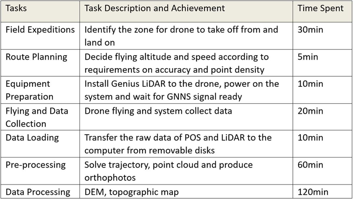
Diaries of Surveying
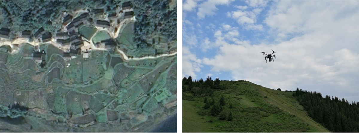
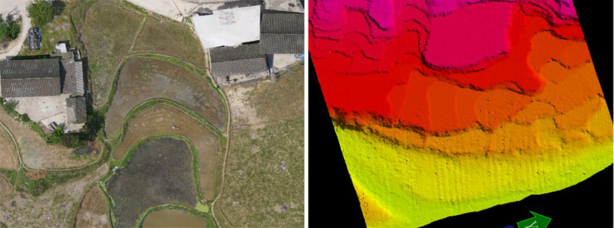
First image: Project environment. Second image: Genius flying with DJI M600.
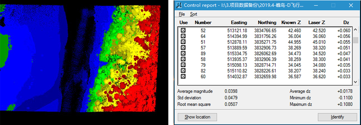
First image: Point Cloud. Second image: Point cloud elevation accuracy verification.
 First image: DOM. Second image: DEM.
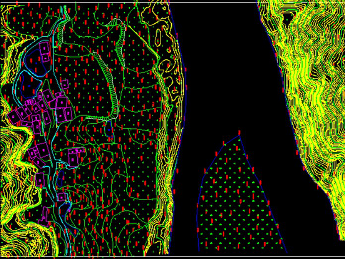
1:1000 scale topographic map.
Mining Survey
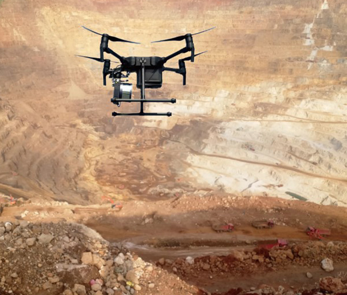 Open pit mine.
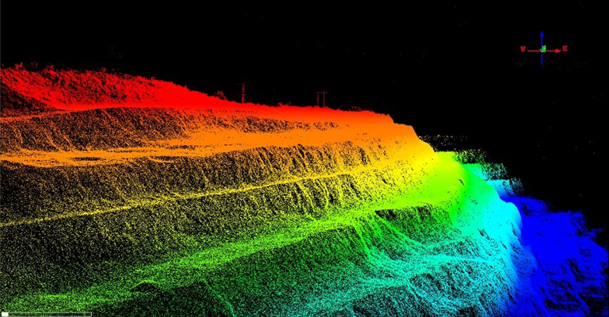 Point cloud collected by Genius.
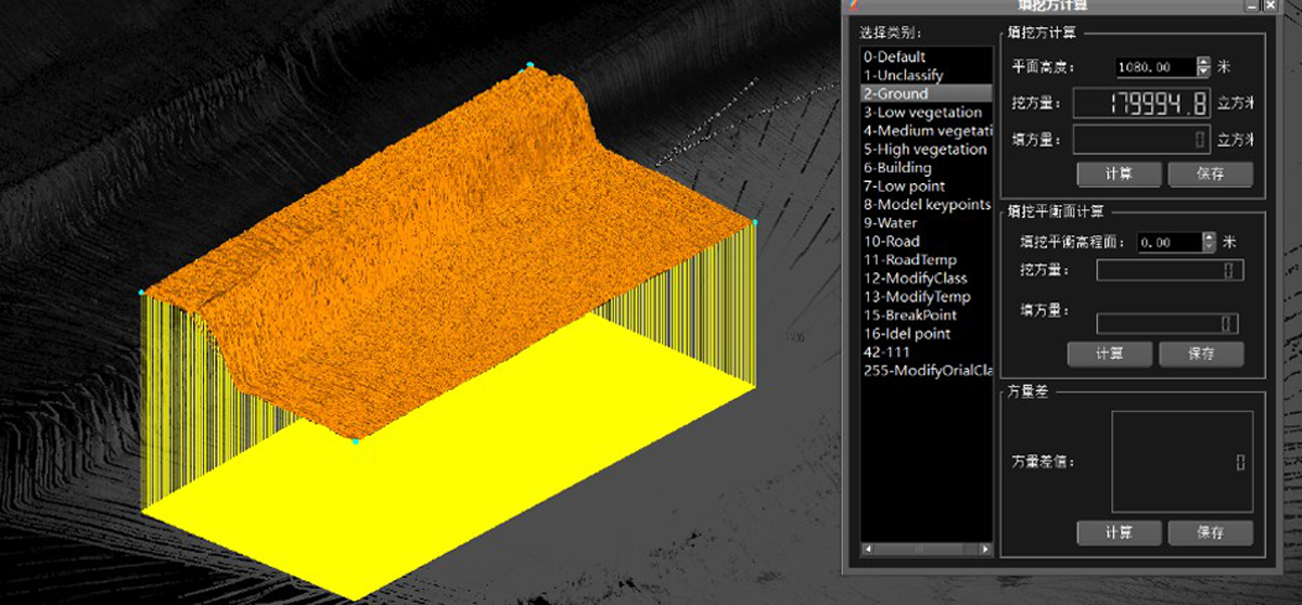 Completed hardware and software package allow for quick volume calculation of open pit mines.
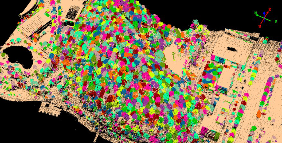
3D Modeling
Point cloud and image can be effectively combined to restore real scenes.
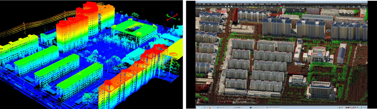 First image: Point cloud collected by Genius. Second Image: 3D model.
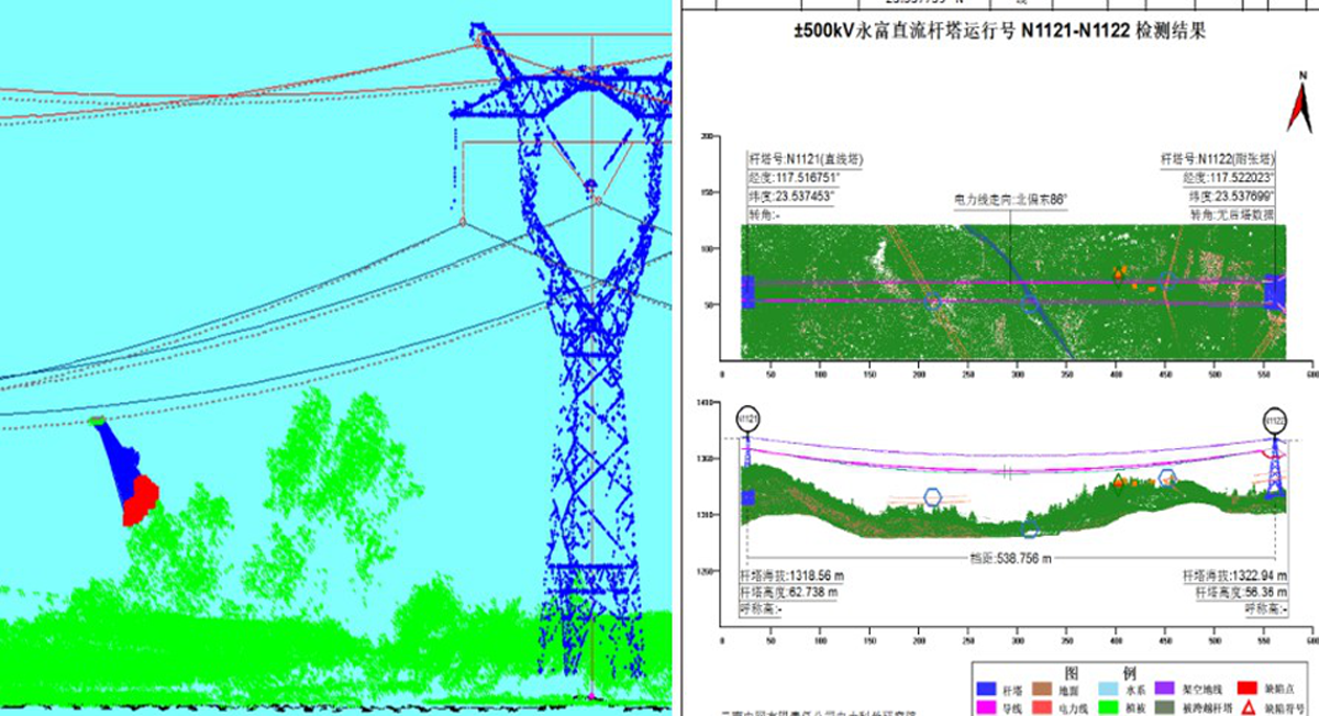
Transmission Line Inspection
Threats analysis along with 3D demonstration of power line, tower and facilities.
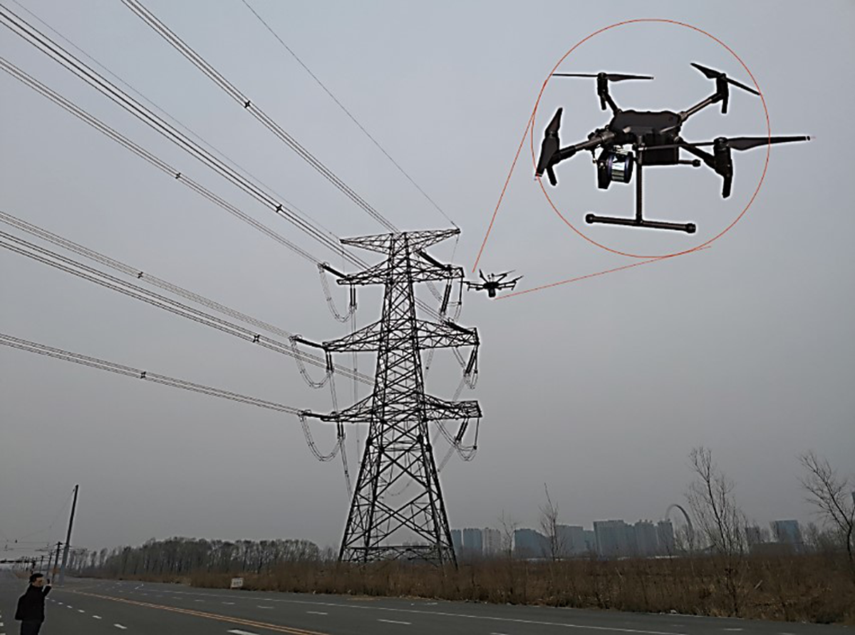 Power line survey.
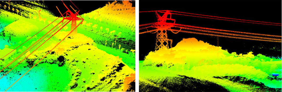 Point clouds collected by Genius.
 Quick detection of vegetation threats along transmission lines.
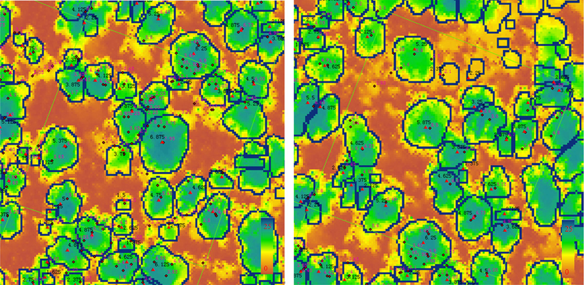 Single wood evaluation.
 Point cloud clustering.
High Resolution Map
Genius is not limited to use only with UAVs. It can be installed on many types of vehicles for high-resolution mapping.
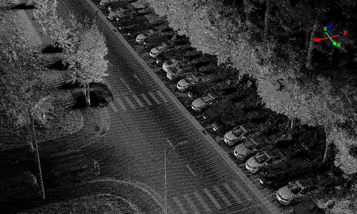 High resultion map.
About SureStar
SureStar was established in 2005 in China to offer LiDAR mapping solutions. SureStar is the one of earliest lidar manufacturers to be involved in integrated-circuit design specifically for LiDAR signal processing (LSP). The high-performance LSP chips, modular design, and unique semiconductor assembly process make SureStar stand out in product performance, low weight, and low power consumption, as well as high production efficiency. In as early as 2014, anticipating an increasing demand for autonomous vehicle and UAV applications, the SureStar team decided to put more effort into the development of automotive LiDAR and lightweight UAV LiDAR.
SureStar embraces complete and comprehensive LiDAR core technologies and has reported over 100 intellectual property rights (patents, software copyrights and trademarks). Quick roll-out of new products comes from a talented and fast-growing R&D team. The SureStar headquarters and R&D center are located in Beijing, while its production facilities are located in Suzhou, and software team in Hefei. In 2018, SureStar set up a representative office in Wixom City, near Detroit, to provide timely technical support to North American clients. SureStar currently has more than 200 employees, of which more than 50% are involved in R&D and technical support.
About Applanix
Applanix, a Trimble Company (NASDAQ:TRMB), develops, manufactures, sells, and supports products and solutions for mobile mapping and positioning. Applanix’ products and solutions are used in a variety of applications, including: road profiling, GIS data acquisition, aerial surveying and mapping, railroad track maintenance, and seafloor mapping. Established in1991, Applanix supports its growing global customer base with exceptional service.