
Survey area overview
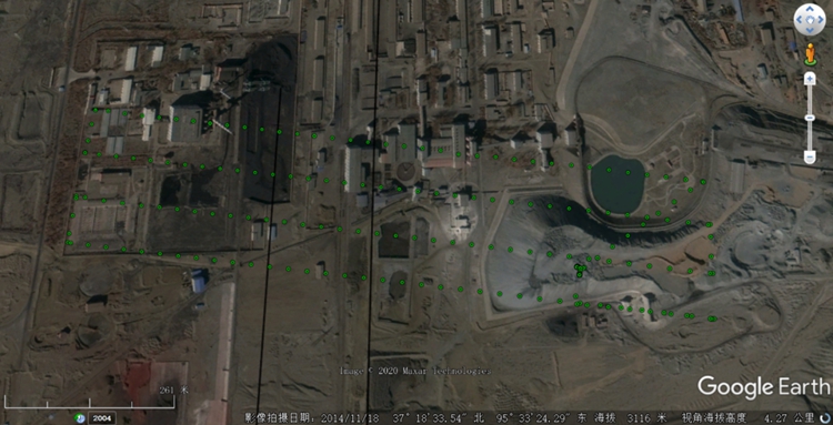
The project is located in Qinghai Province. The purpose of the customer's operation is to survey the mine piles. The pile are located in the open-pit salt field and the Xitieshan mine. The piles are 2000m X 25m and 800m X 50m respectively.
Focus Point
Pile integrity, image acquisition, volume calculation, etc.
Solution
Clouds LiDAR system + Long120 flight platform
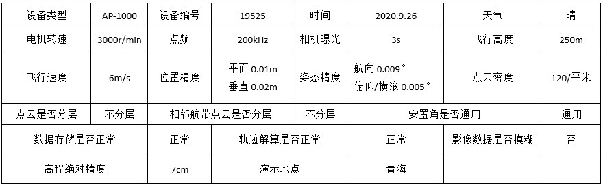
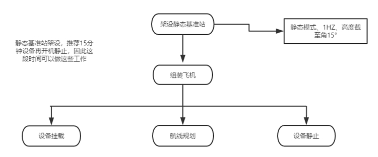
Flight Parameter Settings
Equipment introduction
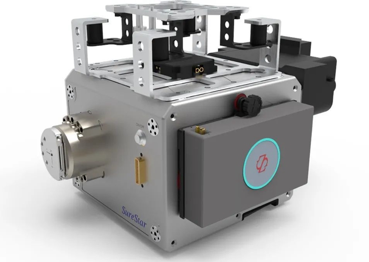
The Clouds system consists of an AP-1000 lidar, an integrated inertial navigation system, a digital camera and a power supply. Small in size and light in weight; according to different configurations, the whole system of Clouds weighs 4.0kg-6.0kg, so it is suitable for most flight platforms.
The Clouds system has the characteristics of fast data collection speed, high measurement accuracy, and long detection distance. It is a miniature airborne laser radar device developed to meet the needs of my country's mountainous landforms and efficient aerial survey operations. It can be widely used in urban three-dimensional, power line patrolling , island reef survey, forestry census, cadastral survey, deformation monitoring and water conservancy survey, disaster assessment and other fields that require agile, efficient and high-precision three-dimensional measurement.
Equipment Core Indicators:
Working height: 100~700 m;
Scanning point frequency: 600,000 points per second;
Ranging accuracy: 5~10mm@100 m;
Positioning accuracy: 0.05~0.35 m;
Image resolution: 42 million/80 million pixels;
System weight: 4.0 kg (including scanner and inertial navigation);
Point density: greater than 100pts/m² (H=200m);
Absolute accuracy: the elevation is better than 5cm, the plane is better than 10cm;
Data storage: pluggable SD card;
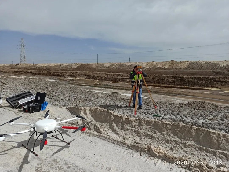
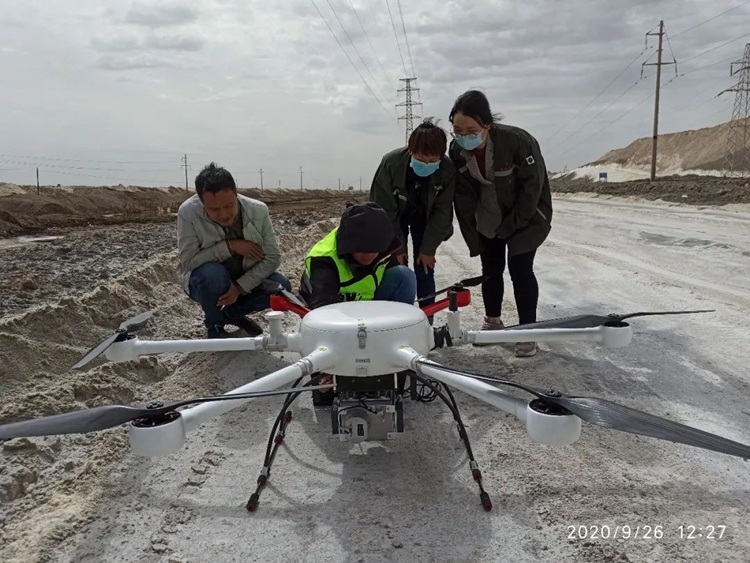
Field work
Basic data production
Raw data solution 10 minutes
raw point cloud data
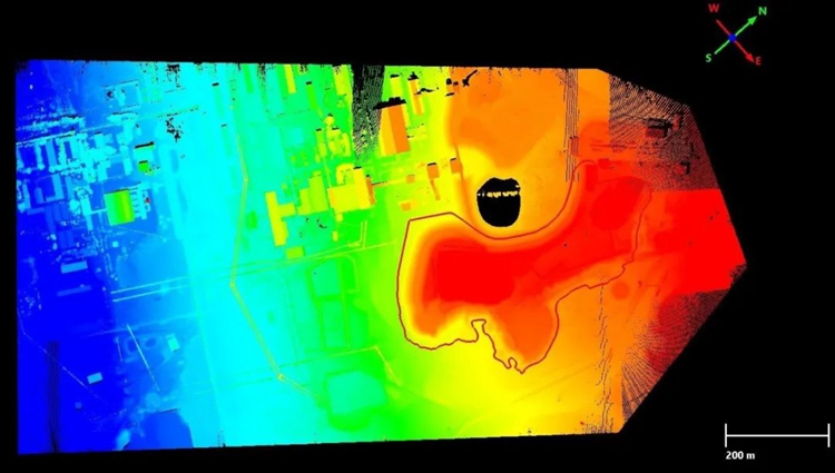
Original point cloud data elevation color display
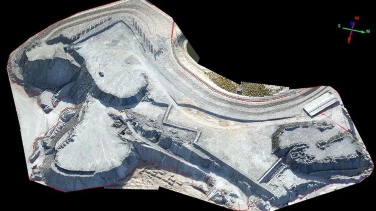
True color display of original point cloud data
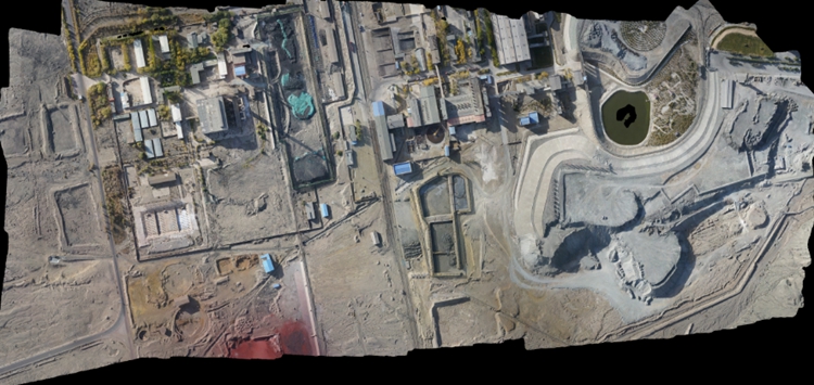
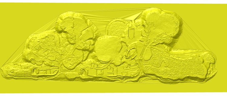
orthophoto data
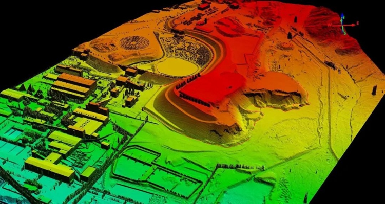
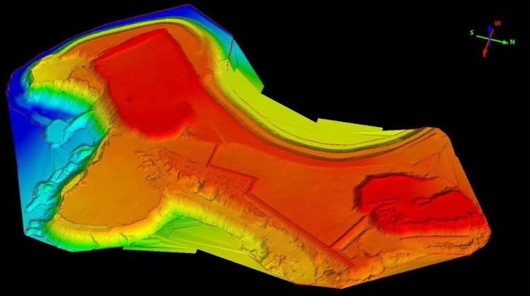
digital surface model
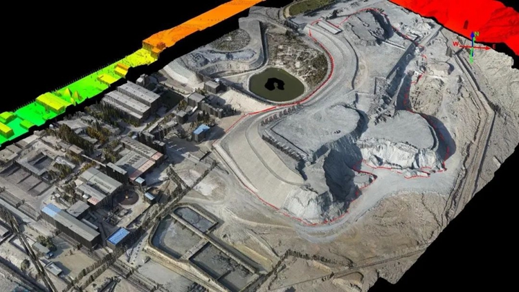
Overlay browsing of digital surface models and orthophotos
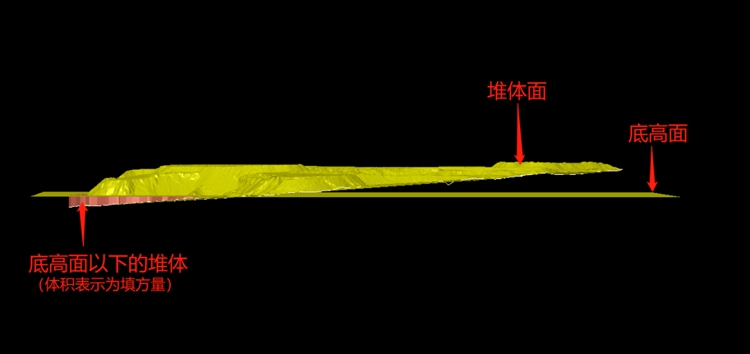
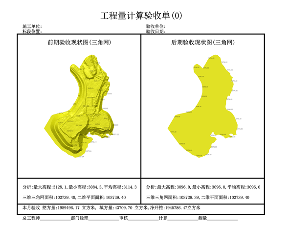
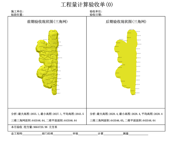
Mine pile calculation
In the mining industry software, one-key volume analysis and calculation is performed by using the triangulation volume calculation method according to the reference elevation plane, the DSM data of the stack and the range line of the stack.
Summarize
Quantity calculation is an important step in mining operations, which is directly related to core issues such as cost, expense, and income. In recent years, with the popularization of lidar technology and its own advantages of high precision, high efficiency, detailed and diversified results, Become the new favorite in the industry.
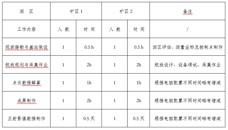
Taking this measurement operation as an example, the efficiency statistics are as follows:
The traditional measurement methods based on total station and GPS-RTK have shortcomings such as low efficiency, incomplete information, and potential safety hazards. Especially in the measurement scenarios of large areas and complex environments, it is difficult for traditional methods to meet the timeliness requirements and accuracy indicators. The specific statistics are as follows:
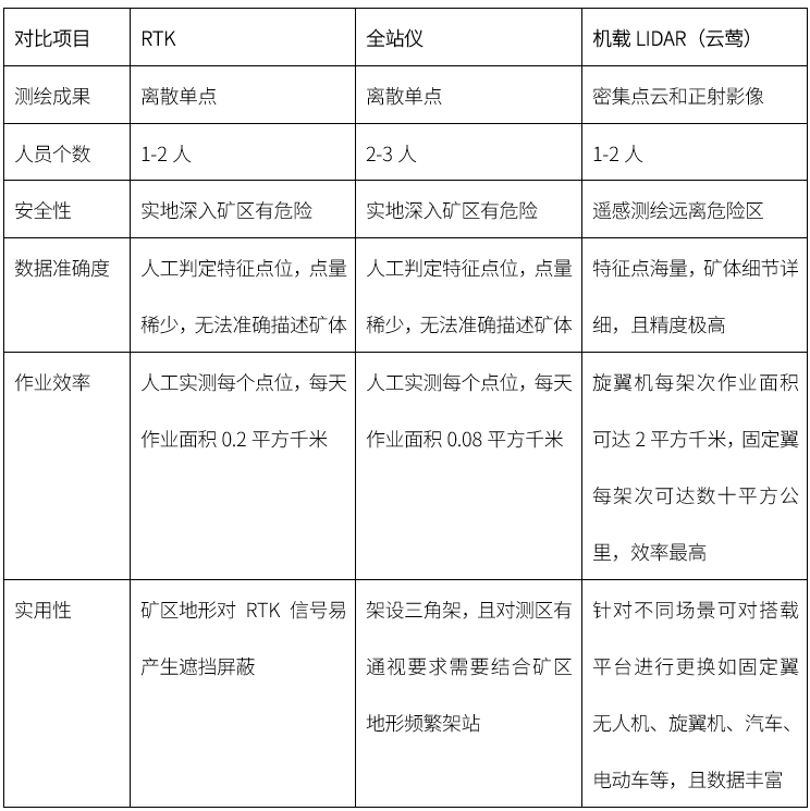
It is intuitively reflected from this operation that its field efficiency has been improved by at least ten times compared with the traditional method. When making results based on point cloud data, the target results can be output arbitrarily according to different needs, which also provides a favorable data guarantee for the construction of the current digital mining area.
To sum up, the Surestar Clouds LiDAR system has played an important role in the application of mines. The measurement mode of UAV equipped with LiDAR has great advantages in terms of work efficiency and project cost. (www.isurestar.net)