
Application of Genius using on construction engineering survey
Application background
In construction projects, every part from survey planning to completion and delivery is inseparable from accurate surveying and mapping work. Traditional surveying and mapping methods have low efficiency and poor data integrity. Many construction companies have applied Lidar measurement systems to terrain surveys, earthwork planning, and completion surveys.
Using Genius Lidar to make non-touching scanning of building, it can get 3D point cloud information and digital image result of survey object in short time. 3D model of the building can be set immediately based on point cloud data and all kinds of data needed in construction progress can be obtained through sectioning and measuration of point cloud model to supervise the construction process or evaluate the impact on the surroundings during the construction process. It provides fast, comprehensive, high-accuracy and low-cost technical method for construction surveying.
Introduction of Genius lidar system
1. System introduction
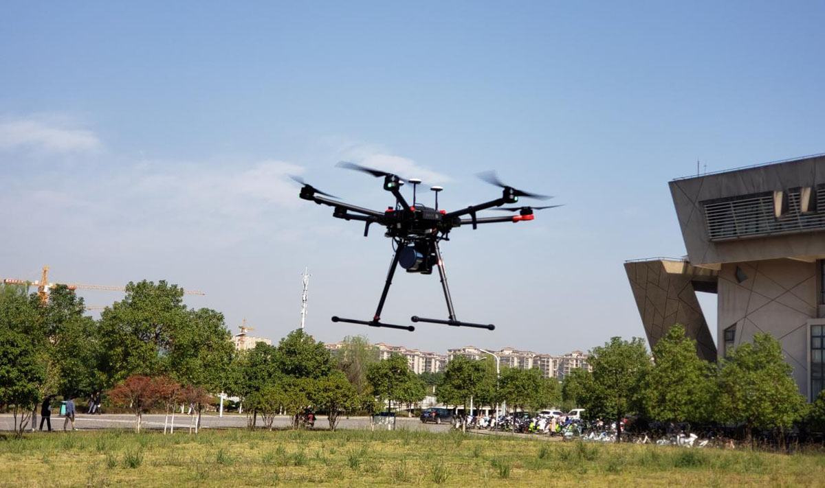
Genius system integrates R-Fans scanner, high-accuracy inertial navigation, high-resolution digital camera and control unit, mainly take uav platform as carrier and obtain high-accuracy 3D point cloud and digital image result under absolute coordinate simultaneously by fast scanning in the air. Based on raw data and image result, it can analyze the dimension, area, volume and other information of object quickly, thus provide real-time data support for construction decision-making and DEM, DLG, vertical and horizontal section and other results in the test area can be obtained accurately by using application software, which can support each part in construction surveying, designing and construction monitoring.
2. Key indicators of Genius
Light weight: The system weighs 1.1kg (without camera) / 1.7kg (with camera); It can be directly mount on DJI M200/210/300/600 series drones.
Long range: Max. range 250m, Max. flight height 150m;
High precision: Accuracy<2cm; Elevation measurement accuracy<10cm;
High speed: 32w pts/s(16 beams)/64w pts/s (32 beams)
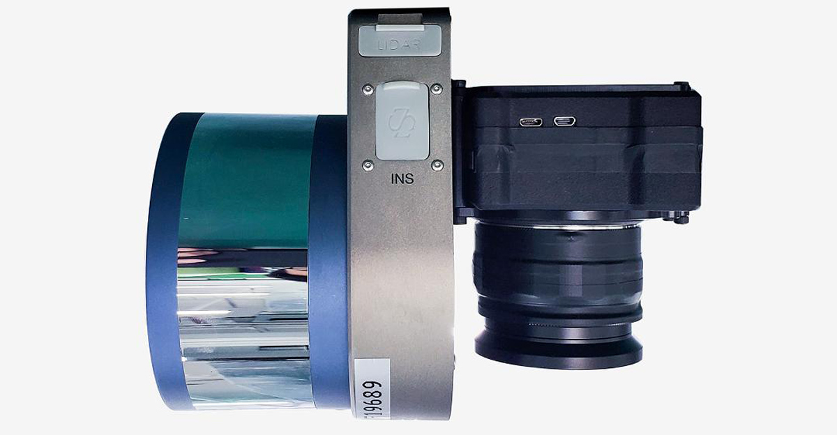
3. System configuration
Flight platform configuration for long duration: Genius + DJI M300,time of endurance up to 40 mins;
Flight platform configuration for single-person operation: Genius + DJI M200,weighs less than 7kg, 宽松空域;
General platform configuration: Genius + DJI M600/or other light-weight uav,easy to assemble and disassemble, adaptable for kinds of drones;
Integrated with camera: customized camera, 4200W pixel, weighs less than 600g;
Software configuration: trajectory solving + point cloud calculating + engineering surveying application software, satisfy the requirement of various achievements in engineering applications.
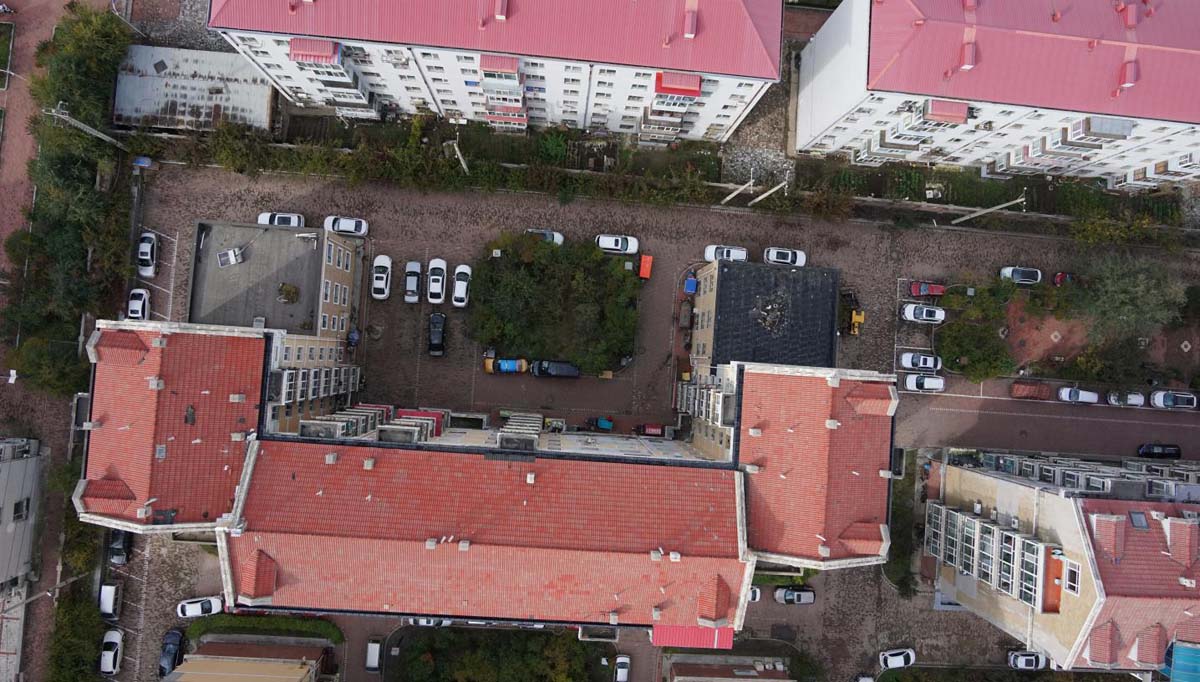
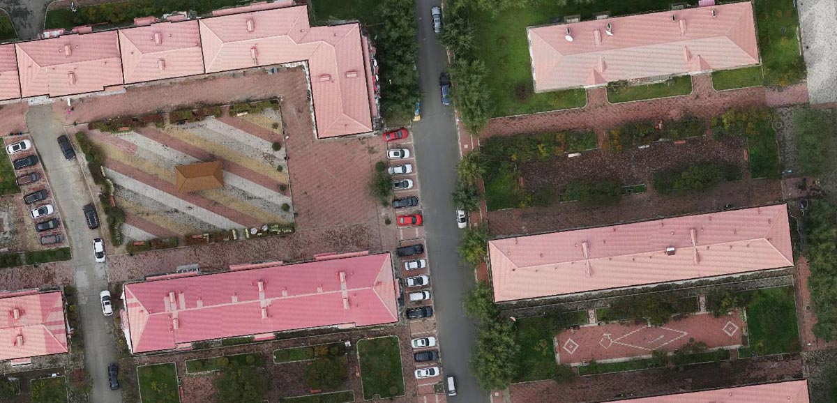
Application 1:Reconstruction project of an old residential community
1. Time
May, 2020
2. Profile of test area
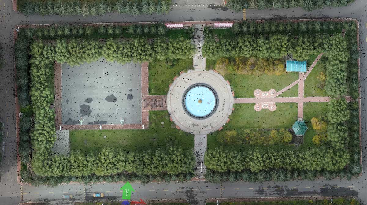
Target: An old residential community in Heilongjiang Province
Area: 0.2km²
Mission: Obtain the three-dimensional information of all the structures in the community, which is convenient for checking the size, quantity and spatial location of different structures so as to support the completion acceptance to judge whether they are qualified.
3. Project implementation
Using the Genius + DJI M300 configuration to scan densely built areas, due to the DJI M300's six-eye visual obstacle avoidance system, it can effectively ensure flight safety;
Plan the route, the speed is 6m/s, the altitude is 80 meters, the side-to-side overlap rate is 70%, and the Genius camera automatically exposes at a distance of 15 meters;
Use ground base stations for post-difference to calculate high-precision flight trajectories in absolute coordinates;
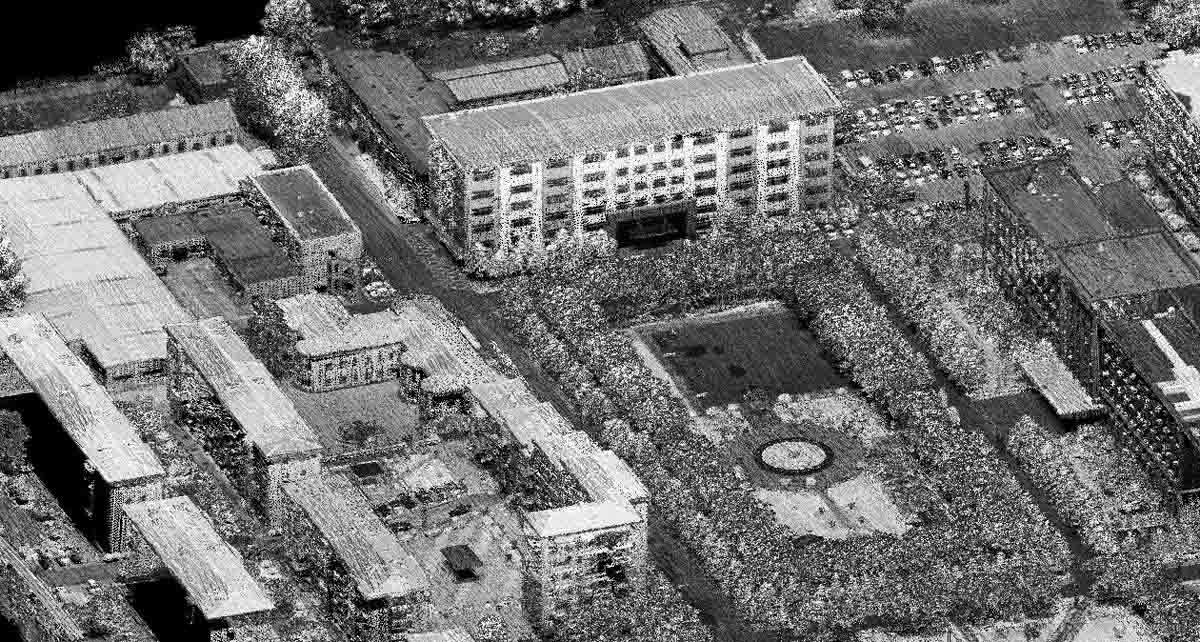
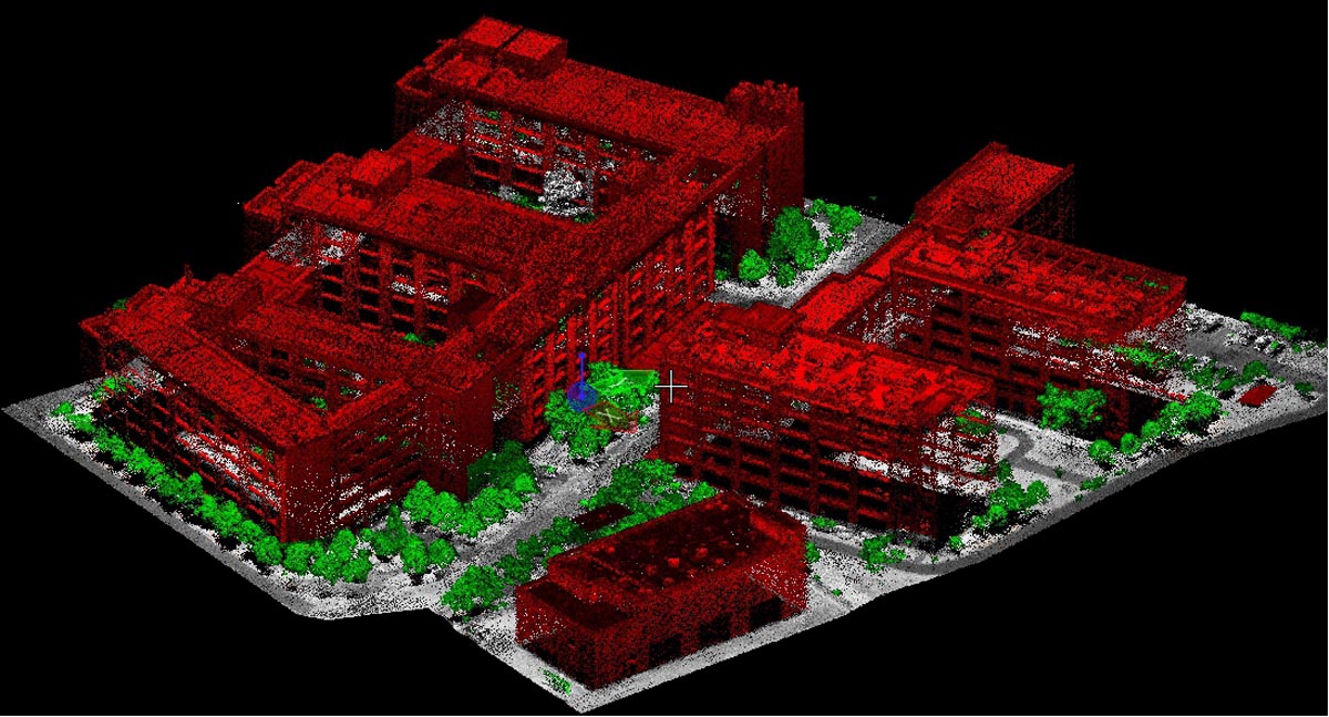
4. Data display
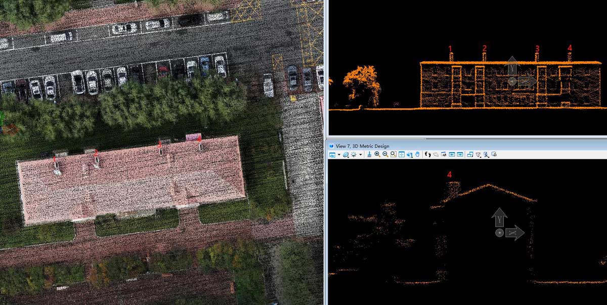
Overall point cloud intensity display mode, the facade of the house and the outline of the building are clea.
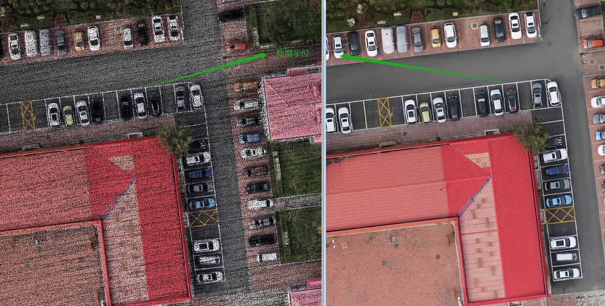
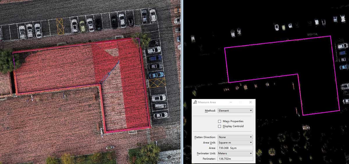
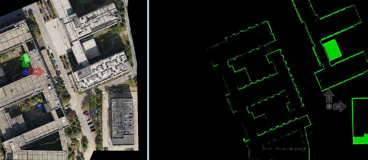
DOM of test area, resolution ratio is better than 3cm;
Point cloud with RGB in test area;
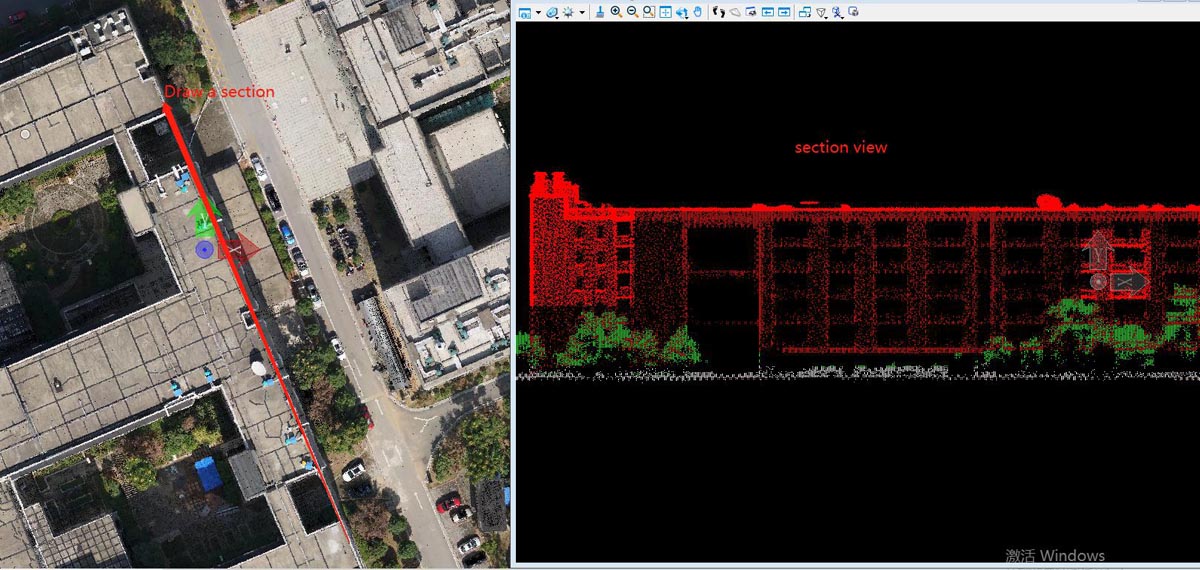
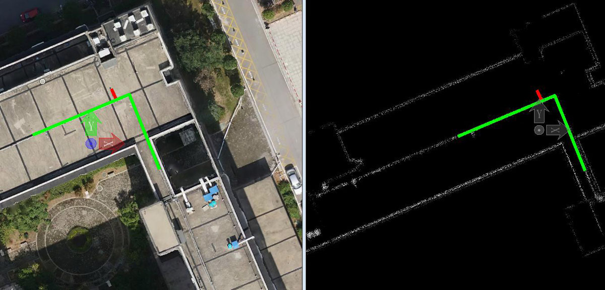
Taking a section of the building, measuring size and other information clearly;
Precision validation report, elevation accuracy better than 5cm;
5. Project summary
Using the results of this flight, the customer processed and generated the as-built drawing dlg of the community and the accuracy of the drawing meets the customer's requirements;
Finishing the statistics of the reconstruction and construction of the community according to the results, including new buildings, parking spaces, green area, etc.;
Application 2: Scanning of a company building
1. Time
February, 2020
2. Profile of test area
Target: A company building in Hunan province
3. Equipment
Genius + DJI M600, free base station
4. Field operation
Route planning:The flight altitude is 110m, the speed is 6m/s, the "#" type route is adopted to obtain enough building facade information, and the scanning area is 0.05Km².
Data calculating onsite: Using PP-RTX data solution service, there is no need to set a base station during the field operation, and the data can be calculated on-site after the flight to check the data quality quickly;
In order to improve the accuracy and quality of the point cloud, two sets of feature point cloud elevations are used for overall correction, thereby improving the level of point cloud elevation accuracy.
5. Achievements
Workload
Flight time: 25 mins
Number of flight: 1 time
Raw data: 2.0G(including point cloud and image)
Cover area: 0.05km²
Achievements display
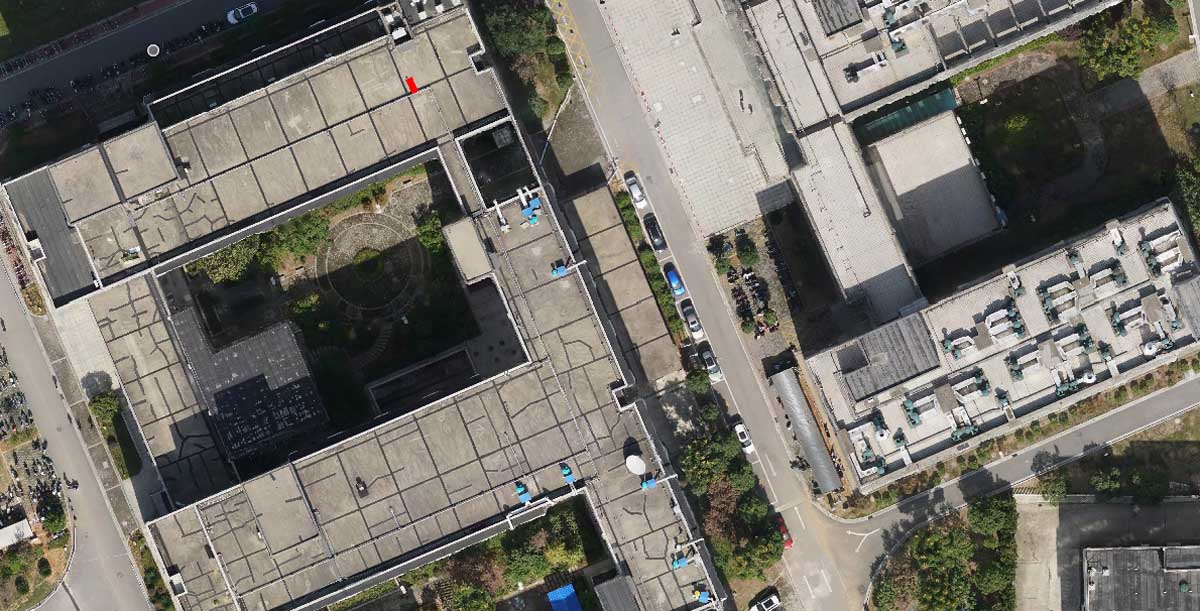
Orthophoto view of survey area--resolution better than 3cm
Point cloud with RGB in survey area-- density 312pts/m²;
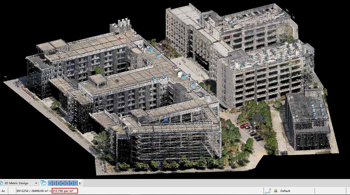
Three-dimensional of point cloud of main building after classification;
Point Cloud-Profile of building;
Point cloud-section view of the building elevation;
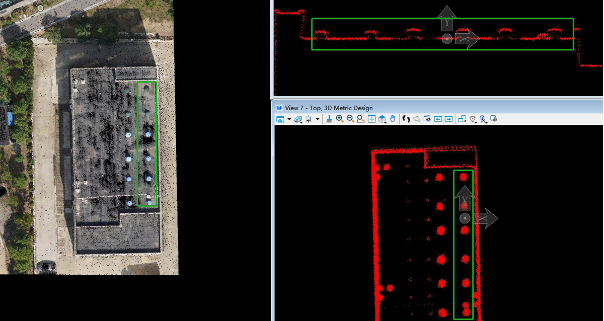
Point cloud-Detail of pipeline on the roof;
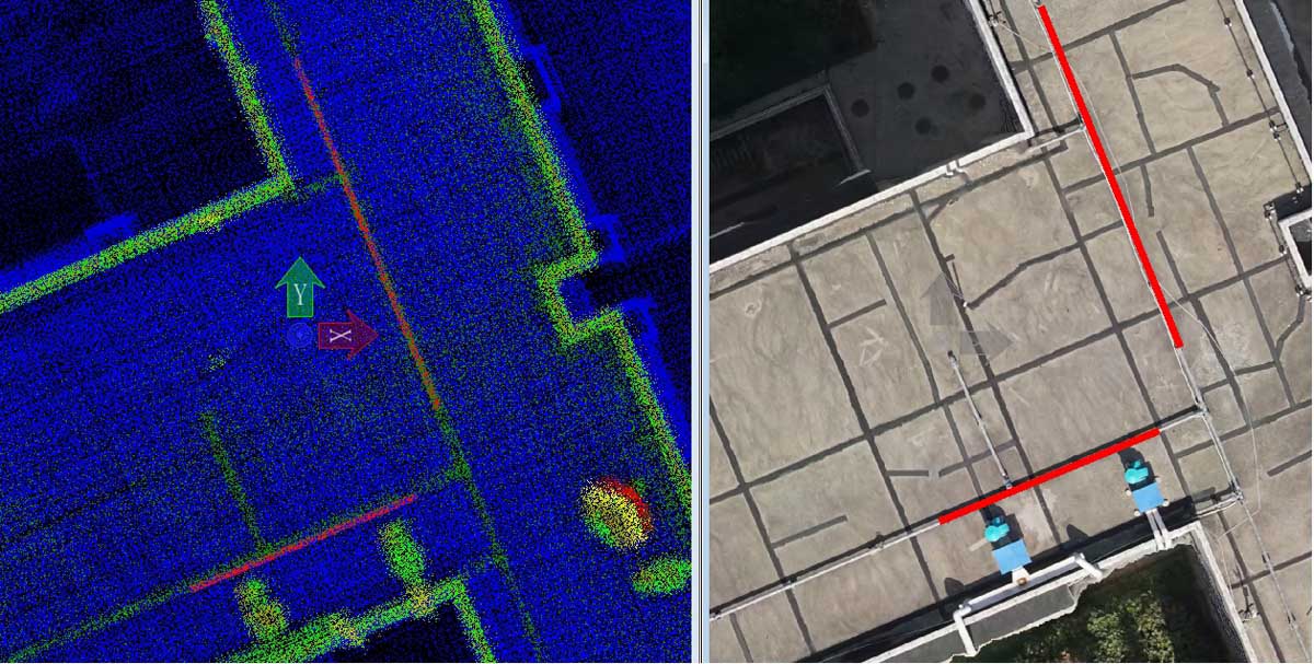
Point cloud-Detail of building roof ;
Evaluation of the results quality
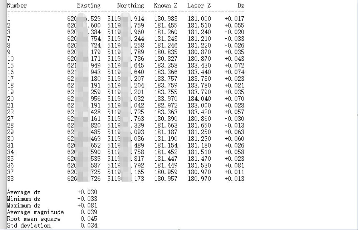
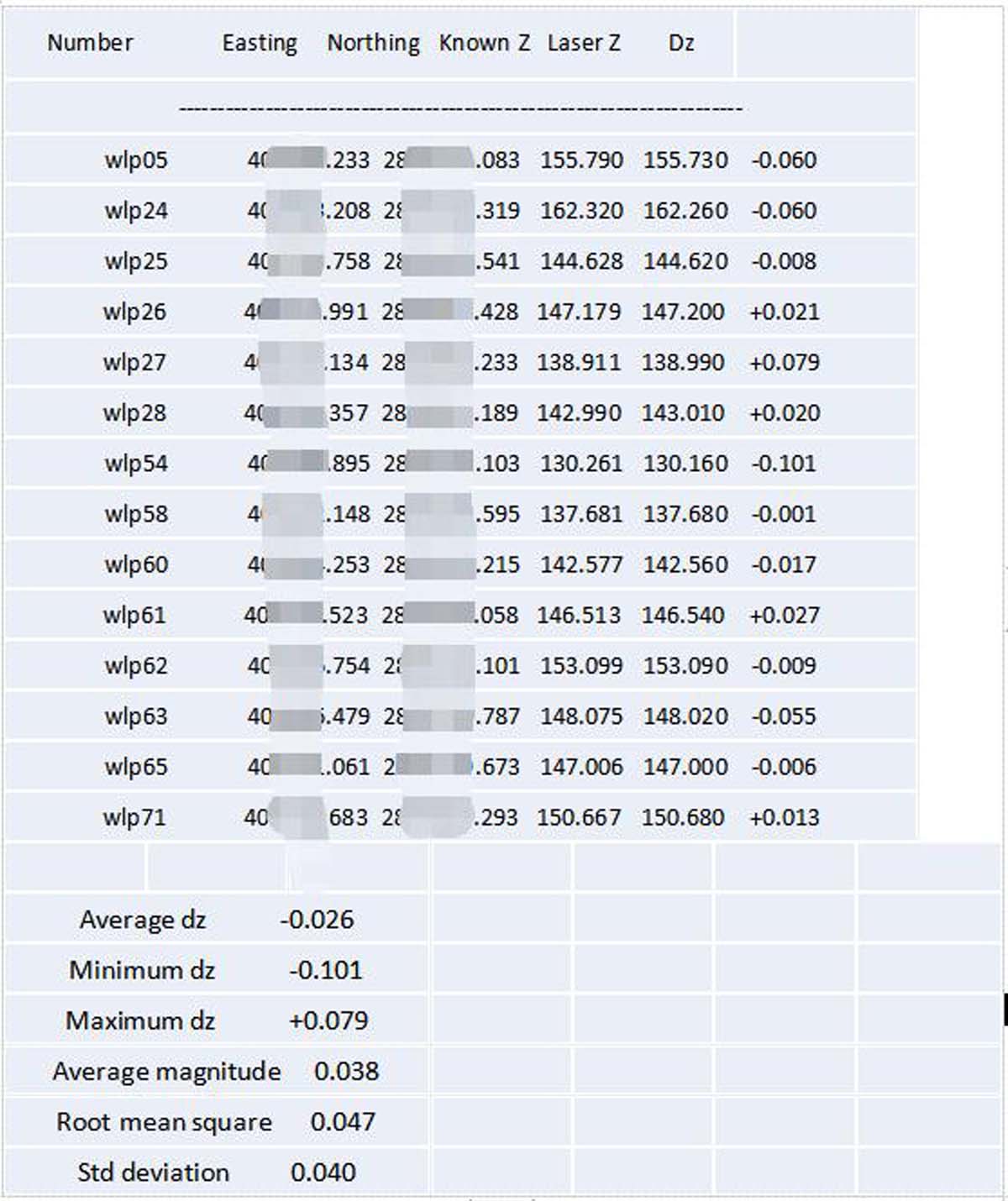
RTK was used to collect feature check points in the area, and point cloud accuracy was evaluated through comparison. The plane accuracy is better than 10cm, and the elevation accuracy is better than 4cm;
6. Conclusion
The Genius system is used in construction engineering surveys, adding some control points to optimize the overall accuracy of the point cloud. It can obtain point cloud results with elevation accuracy better than 5cm, plane accuracy better than 10cm, and also can obtain digital orthophoto results with resolution better than 3cm, which can meet the needs of high-precision topographic surveying and mapping;
The Genius system uses the base station-free operation mode to complete the scanning of 0.05km² terrain, which greatly reduces the time of field operations. In this case, all field operations were completed within half an hour, which greatly improved the operational efficiency of building construction surveys;
Obtain multiple results such as point clouds and images simultaneously for long-term preservation. For different construction periods and different purposes, using rich raw point cloud and image results to analyze and extract different measurement data and model analysis structures and reduce repeated measurement work during construction;
Based on the airborne lidar non-contact scanning, the scanning results of the target are acquired in one flight and the surrounding environment information is obtained synchronously, which can provide effective data support for the image evaluation of the surrounding environment of the construction.
SureStar Technical support