
Blog
-

Research on Navigation system of Inspection Robot based on Lidar
The intelligent robot navigation system can be set up by software to define the standard content of the lidar operating system. -
The Main Technical Branches and Development trend of Vehicle LiDAR
The on-board lidar system is referred to as the “eyes” of autonomous vehicles, and is a key sensor for realizing autonomous vehicle environment perception. -
Vehicle-borne 3D laser mapping lidar
Three-dimensional lidar technology is a popular technology that has gradually developed in recent years and is one of the revolutionary achievements in the field of photogrammetry and remote sensing mapping. -
Airborne LiDAR Technology and Its Application
Airborne LiDAR technology is a new type of measurement system that is more and more widely used, which can quickly obtain high-precision 3D data. Airborne LiDAR technology has been widely recognized as an accurate and fast 3D measurement method of the earth’s surface -
Application of modern navigation lidar
Navigation lidar not only serves the traditional ship navigation field, but also gradually expands its application to the fields of integrated port management, ecological environment protection, and security monitoring and scanning. -
Research on Application of Airborne Lidar Technology in Power Engineering
The airborne LiDAR integrates GPS, inertial navigation system and laser technology, which can quickly and accurately obtain massive 3D spatial data of the desired target. -
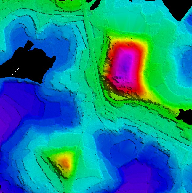
Analysis of Topographic Map Mapping Technology Based on Airborne Lidar Data
Compared with traditional aerial photogrammetry technology, airborne lidar technology has the advantages of direct and rapid acquisition of three-dimensional spatial data, high data processing automation, high data accuracy, low operating costs, and easy cost control. -

Features of Airborne Lidar and Its Engineering Application
Airborne lidar technology is a rapidly developing new technology. It integrates a variety of technologies and has become an important technical means for spatial data acquisition. -

Airborne lidar technology and its application in power engineering
Airborne LiDAR measurement technology will be one of the future development directions of measurement. It has many unique advantages. It can fully meet the accuracy requirements of the survey and design of transmission lines, railways, and highways, and can effectively improve the efficiency of survey and design. -
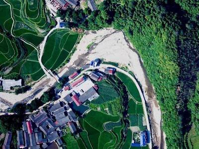
Application Practice of Airborne LiDAR Technology (LiDAR) in Aerial Survey
LiDAR is an airborne laser detection and ranging system installed on an aircraft. It generates LiDAR data images by measuring the three-dimensional coordinates of ground objects.


